
Utah’s White Rim Trail seems to be enjoying a bit of a popularity boom in recent years thanks in large part to repeated attempts to set new Fastest Known Time records by a non-stop stream of world class riders. While those efforts are incredible from a human achievement point of view they don’t resonate much with me as it relates to my relationship with this beautiful and incredibly unique part of the world. I come to White Rim with slower times in mind, and with thoughts of long miles spent undisturbed by life’s complexities.
While on this trip one of my goals was to try to document as much as possible and share thoughts / conditions with people who are thinking of tackling this route themselves. I brought along my 360 camera and recorded clips along the route. Little did I know that I would gather almost an hour of video, a lot of it monologue, but that is how it turned out so I’m embedding it here as a companion piece to these words for people who want to be as dialed on the route as possible before taking it on.
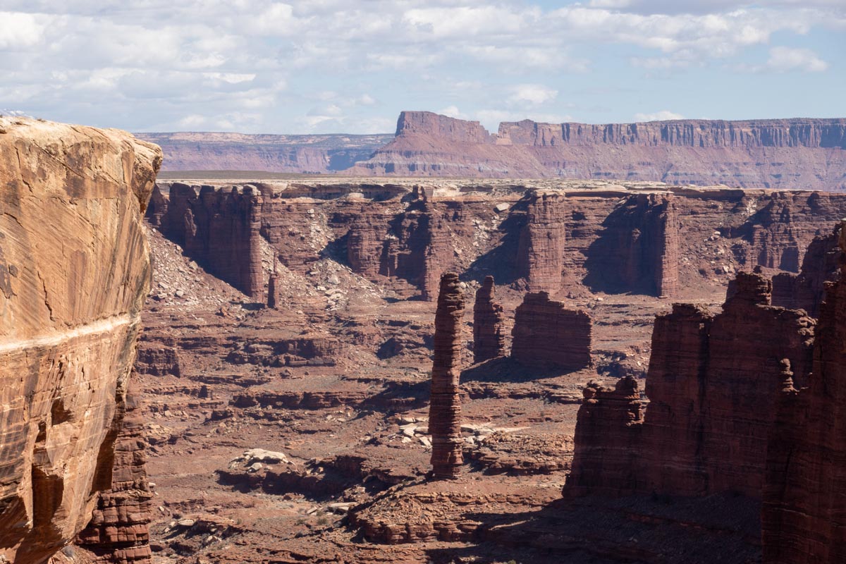
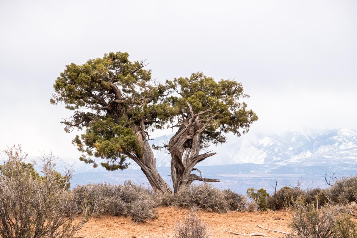
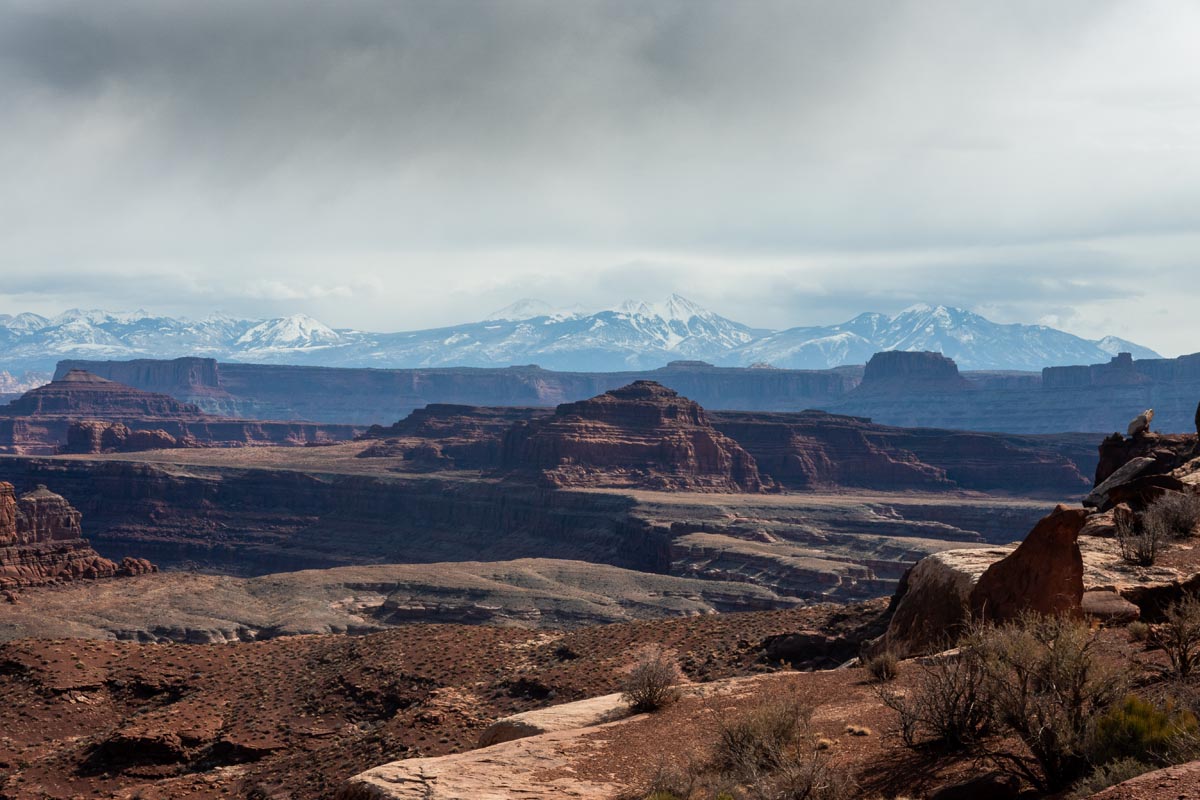
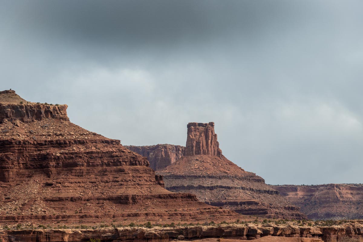
To me White Rim and Canyonlands National Park is special for its staggering other-ness. It is unlike almost any place I have ever laid eyes on, and to ride through it is to step through a place that aches with history that is not counted in days but of untold years reaching impossibly far back into history that cannot be known. A mountain covered in trees is effectively just as old, or young, as this place is. A lush Pacific island is just the same. But White Rim, and most of the Utah desert for that matter, just feel older because there is almost no young vegetation that masks the eroded bones of the earth itself. White rim is raw, exposed, and seemingly un-changed by the measurable passage of time. To ride your bicycle through it is to be a guest, present for a mere moment. If you do it correctly, there will be no signs that you were ever there even minutes after you’ve left. The desert can’t wait to forget about you, but I dare you to forget about this desert.
Before white people ever showed up the Utah part of the world whether on horseback, in wagons, in Jeeps, or on bikes, the area was inhabited by Native American tribes including the the Navajo, Ute, and Paiute Indians. Not having extensively read about the history of the area myself it would still be sadly be safe to assume that these lands were unjustly stolen from its original inhabitants in much the same ways the rest of America was wrenched from the hands of its native peoples. I’ve read a fair bit about the neighboring San Juan mountains, and the story of how the area was swindled from the Mountain Ute tribe through a string of thefts masquerading as treaties is nothing short of a crime and tragedy. These realities have not been correctly or fully addressed since those times, but being aware of them as we recreate and play on these lands is worthwhile and important to me.
My intent on this trip was to be as aware as possible. Of history. Of my surroundings. Of myself. Whereas I had once previously ridden White Rim with a band of friends, this return visit to the area was to be done alone. It was a to be a test of myself and my equipment. It was to be time spent in a place that is quiet enough to actually hear myself think. It was meant to be just a bit escapist and hopefully even more so restorative to my mind.
I’m sure most people reading this can identify with the building feeling over the last year that the world has gotten smaller and that the walls have closed in on us all. The pandemic has affected us all differently, but to anyone with an adventurous spirit this last year has been tough to navigate in terms of wanting to explore the world we live in while almost universally needing to stay closer to home. Some of us are more fortunate than others though. The Rocky Mountains sit outside my door, and White Rim is a six hour car drive from my house. In terms of finding a place where the world still feels wide and infinite there are few bigger bangs for the buck than the six hour drive to the starting point of my ride in Mineral Bottom, near Canyonlands National Park.
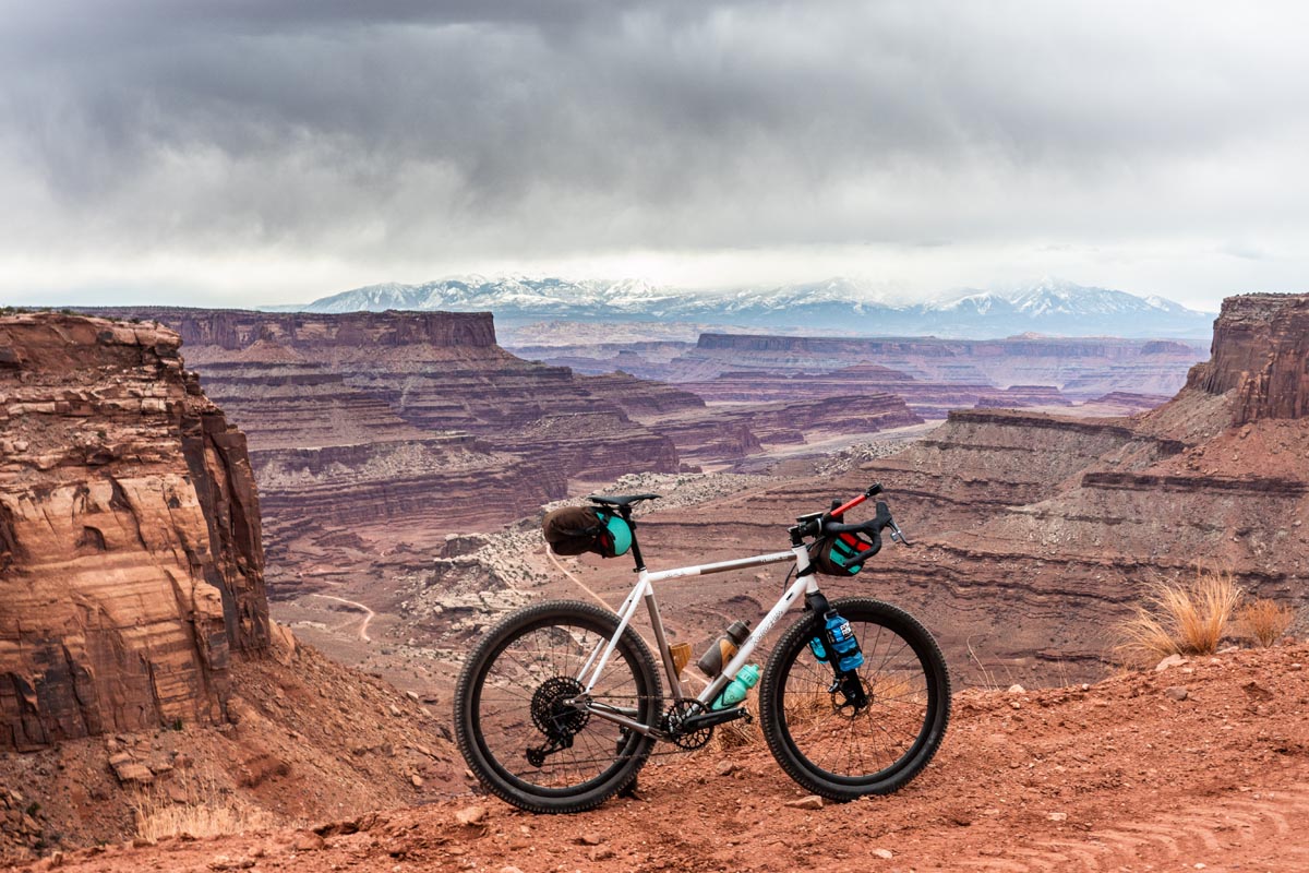
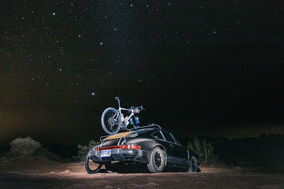
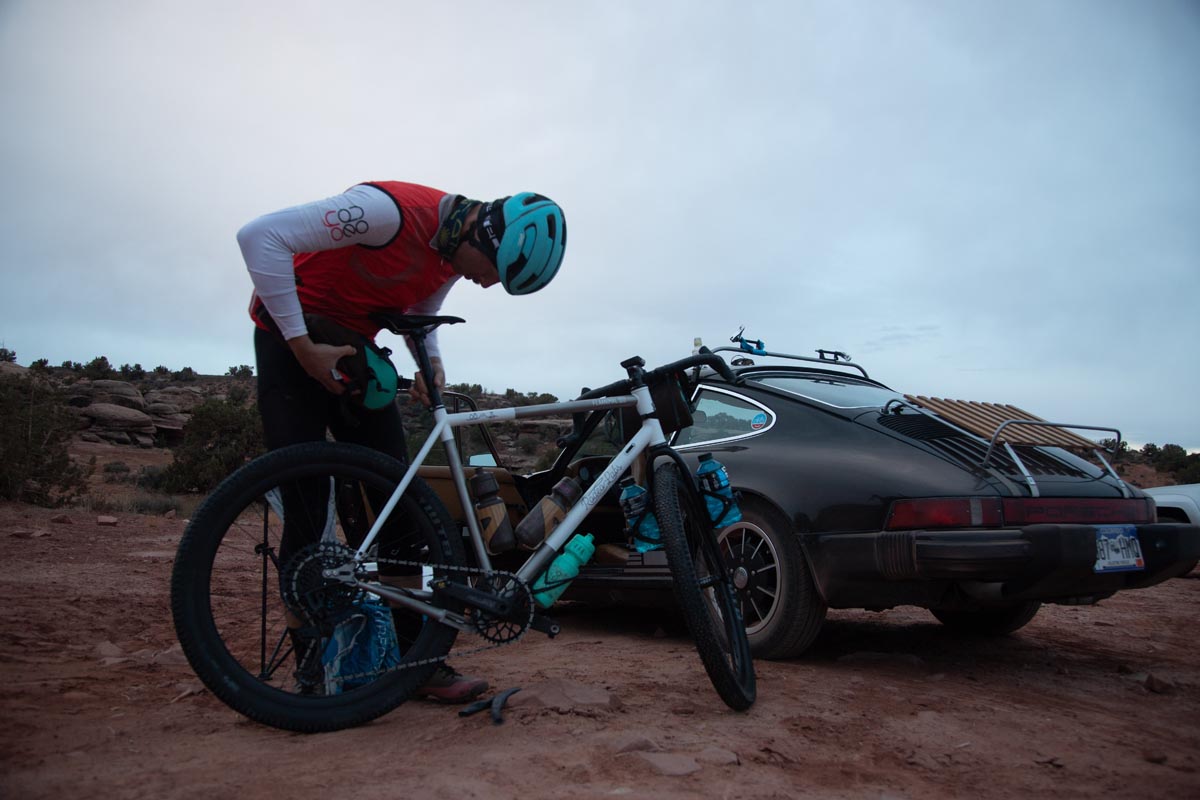
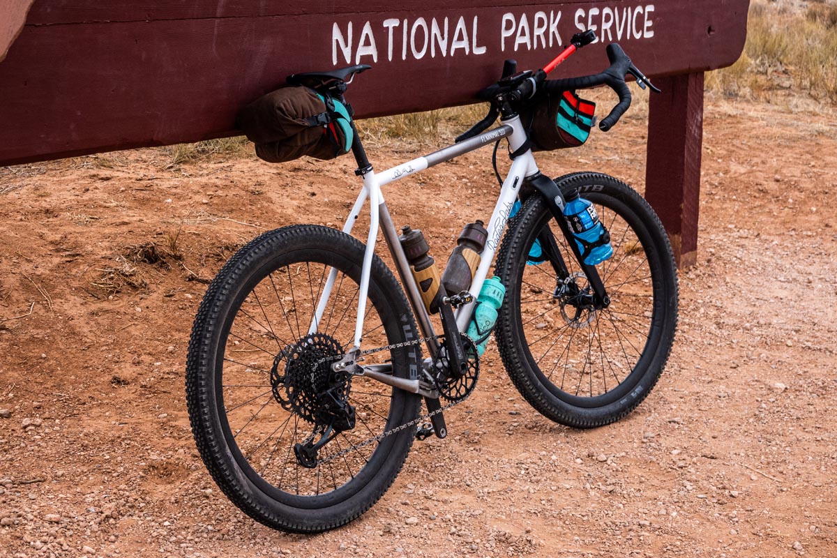
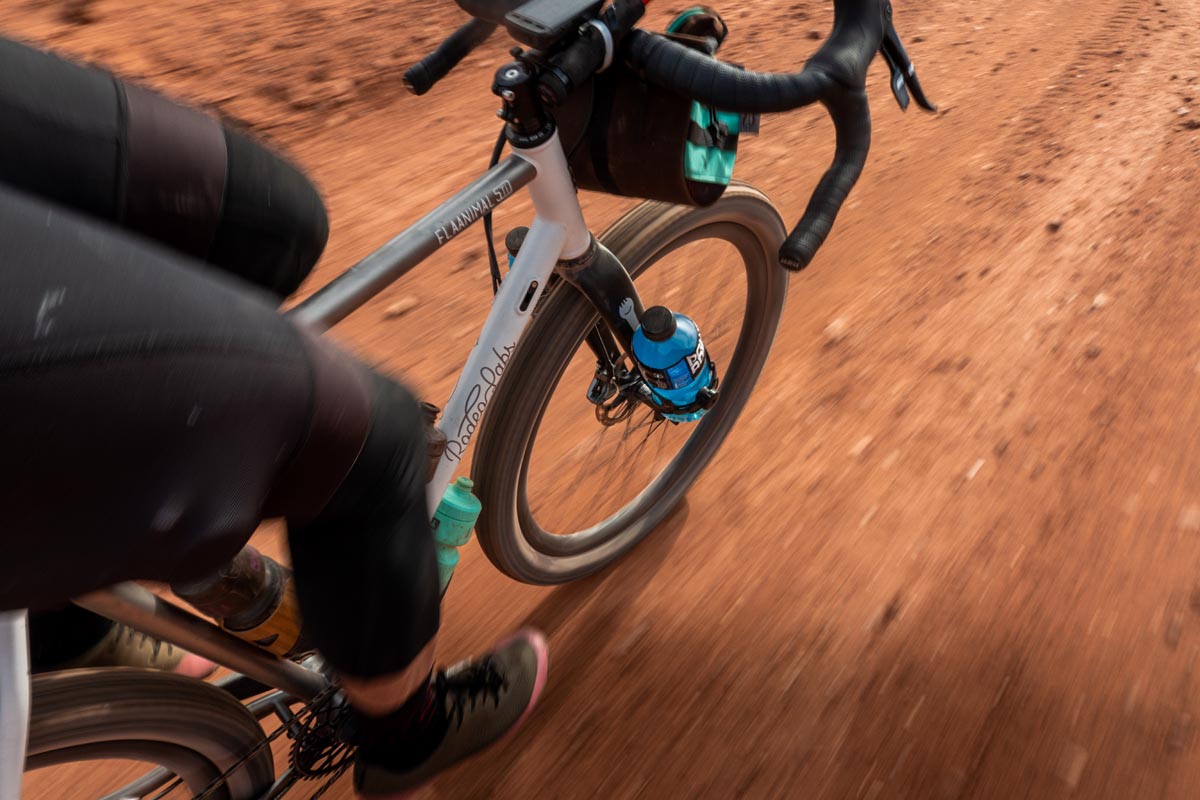
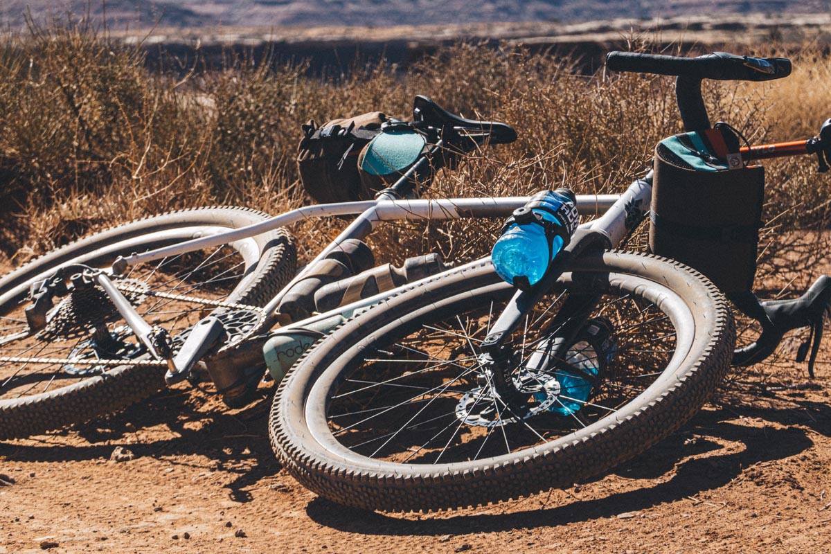
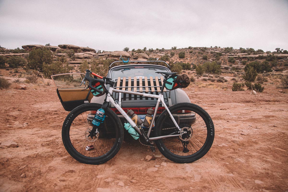
My bike of choice for this ride was our new Flaanimal 5 Titanium. In 2014 we rode this same route on Traildonkey 1.0 and we did it on 35-40mm 700c tires. The first attempt was successful and enjoyable for us but it was also quite jarring at times. Anyone who knows anything will tell you that White Rim Trail is mountain bike territory, and they wouldn’t be wrong. Big tires, soft shocks, and all the comforts of a modern mountain bike will without doubt make White Rim easier and more enjoyable for most riders. But I’m not most riders. I’m me. I long ago took the off ramp from the “easier and more comfortable” highway and willingly lost myself on more challenging and less comfortable B roads. I like difficult things. I like seeing if I can frame a challenge for myself and overcome it with minimal drivers aids or mechanical advantages. Most importantly though I just enjoy riding my bikes, Rodeo Labs bikes; the bikes that myself and my team have ushered into existence. That last point my not be universally relatable but I do know for a fact that there are plenty of other slightly twisted people out there that also enjoy taking their drop bar bikes anywhere and everywhere – to the point of absurdity. But the 100.4 mile White Rim route isn’t even really absurd to do on bikes like ours. It is merely challenging and at times very very fun.
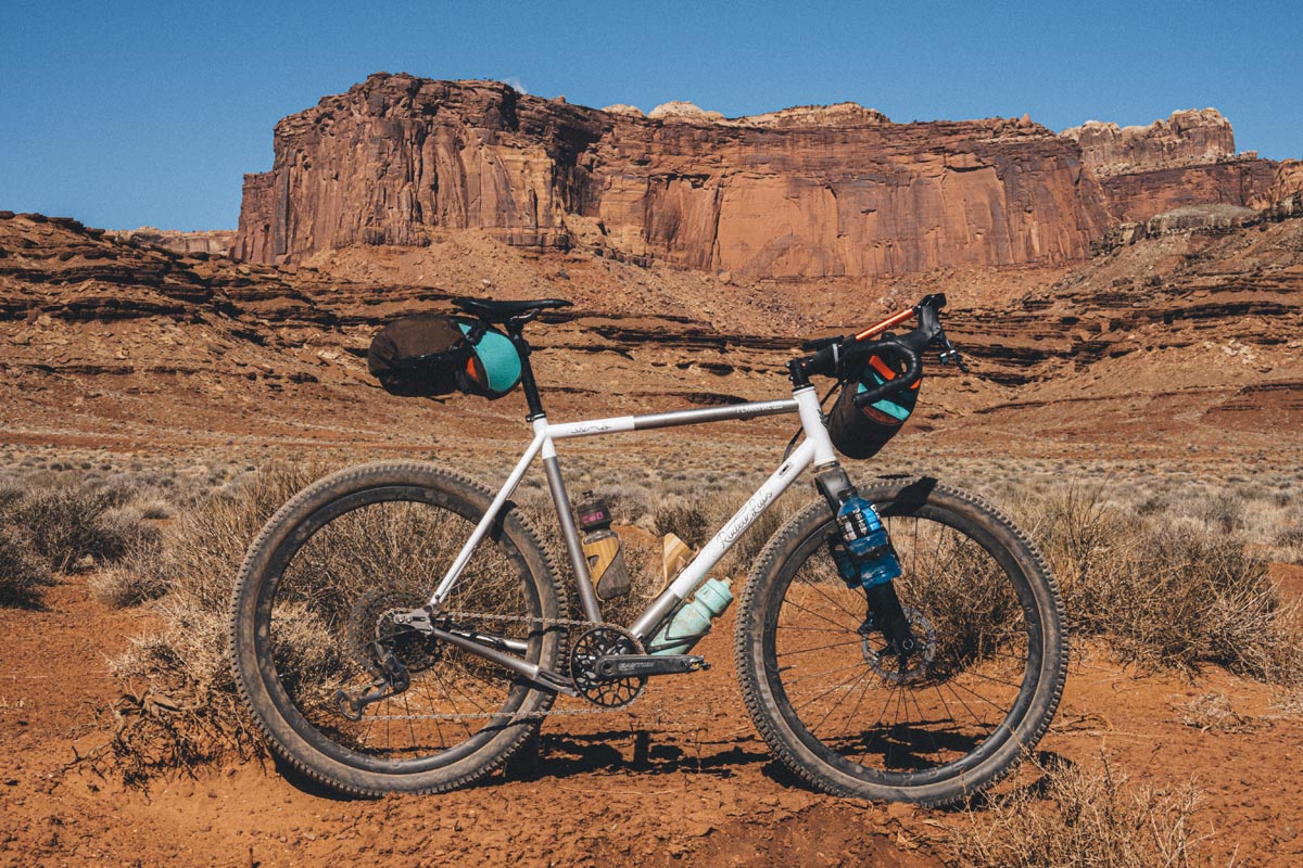
In contrast to 2014 I did upgrade my gear a bit. Flaanimal 5 is light years more evolved than the 1.0 Donkey. Gone is the hacked 2x drivetrain of yore. Gone are the sub-optimal mechanical disc brakes. Gone are the small-ish tires and rigid stem. In its place the new bike has pretty massive 2.4″ WTB Trail Boss tires aired down to just below 20 psi, a night and day difference in comfort from the 2014 tires. The hydraulic disc brakes on 4.0 are phenomenally capable and never suffer from line contamination or cable stretch. The rigid stem was replaced with a Redshift Shock stop which allowed for 20mm of flex on the biggest bumps. The carbon Ritchey Venturemax bars flexed even more on top of that. The Quasar saddle and bar tape were chosen after six years of non stop trial and error. My gearing was a 1x drivetrain consisting of a 40t up front and a 10-50t in back which gave me a ratio for super fast road cruising and steep, technical dirt climbs – both of which feature on the White Rim route. I didn’t have any doubts that my bike would be up to the challenges of the course, and at the same time this would be the most aggressive route that I had yet taken it on and I was excited to observe and contrast from my first White Rim expedition.
As someone caught between the pressures of running a growing bike company and the pressures of 3 kids and a modern family, time is the most scarce resource in my life right now. As I felt the pent up wanderlust building over the winter months and increasing Covid lockdowns of late 2020 I started doing mental calculations in my head. How could I find a slice of time with which to disappear from life for this ride, and how big of a slice would it need to be? I knew that March brought about the onset of riding season in the warmer desert areas of Utah, but I didn’t know how early was feasible for this trip. In mid to late February I started looking at the extended forecasts for the Moab area and to my surprise they already looked pretty agreeable. Farenheit temperatures were in the 30s at night and 50s to 70s during the day. Cold camping temperatures are very survivable, and cooler daytime temperatures are great for White Rim because it keeps your water consumption lower on a route with almost zero places to resupply your drinking stores. Whatever water you need on this route you have to carry with you from the start. To ride White Rim solo is to ride entirely self supported.
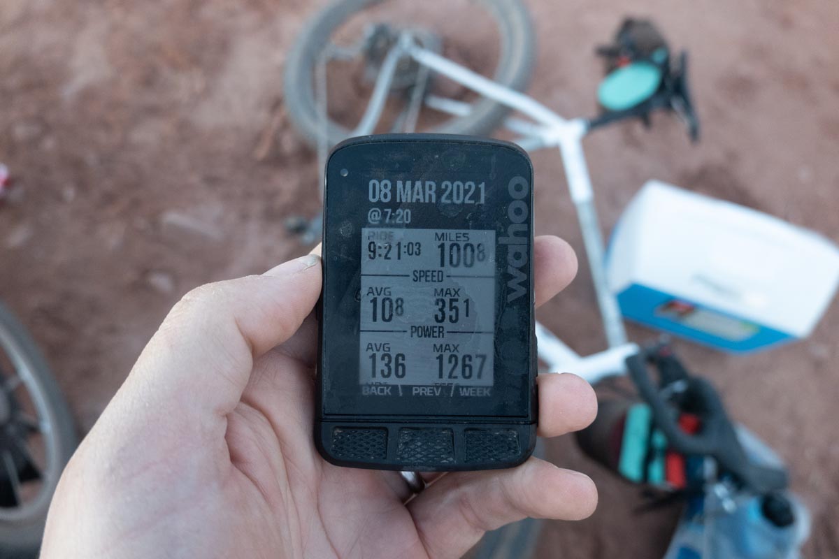
I kept the forecast in the back of my mind while I navigated our busiest February ever at the Rodeo office. I knew that me leaving for the weekend wouldn’t go well with the family so I wanted to make this a week day trip and steal that time from work instead. I calculated that if I left around 2-3pm I could be at the Mineral Bottom camp location by 9-10pm that same night. If my gear was well prepped I could be up at 6 or 7am and pedaling soon after. If I could average around 10 miles per hour then I could complete the route in about ten hours which would have me back at the car at 4 or 5pm. If I started the drive home around 5:30pm I could be home by about midnight, about 34 hours after I first left my house. 12 hours of driving + 10 hours of cycling combined would be undeniably exhausting, but the exhaustion would be worth the escape and the time spent alone to think, undisturbed and riding through one of the most beautiful places I’ve ever been.
Even though spring was approaching the forecast soon began to show signs of winter weather and I knew that I had to act quickly or I might be caught waiting for another window through a wet, snowy spring. I decided to leave on the afternoon of Sunday the 7th and do the ride on Monday the 8th. Gear was quickly sorted and my 28mm slick commuter tires were replaced with the 2.4″ off road treads. I drove west on I70 with high spirits and six hours of podcasts queued for the drive. The schedule that I had envisioned mostly held true as I arrived at the campsite above Mineral Bottom around 10pm. The night air was still wonderfully warm at 50f, so I simply unrolled my sleeping mat and bag next to the car instead of bothering with a tent. A very persistent camp mouse and a trillion stars were my only companions that night. I had the place entirely to myself. I was completely alone and I loved it.
I try sometimes to explain to my extroverted wife why I, the introvert like being alone so much. To her that reads as me wanting to get away from the family. The reality though for me is that I simply think that life needs to swing between closeness with those you love and back towards periods of solitude in which it is safe to turn all the way off and go inward for a bit. Running a business is a constant dialogue and is in a sense like having a second family. To go to work is to be fully engaged for eight or nine hours, and to come home is to spend most of the rest of those waking hours with the even more real, more deserving family. To be engaged all waking hours of the day will eventually run an introvert dry. One must be allowed a period of mental and relational retreat or your mind will eventually revolt. You’ll cease to be able to function, you’ll be empty, and you’ll not know who you are anymore. As far as geography goes I highly recommend the desert as a place in which to practice the discipline of aloneness.
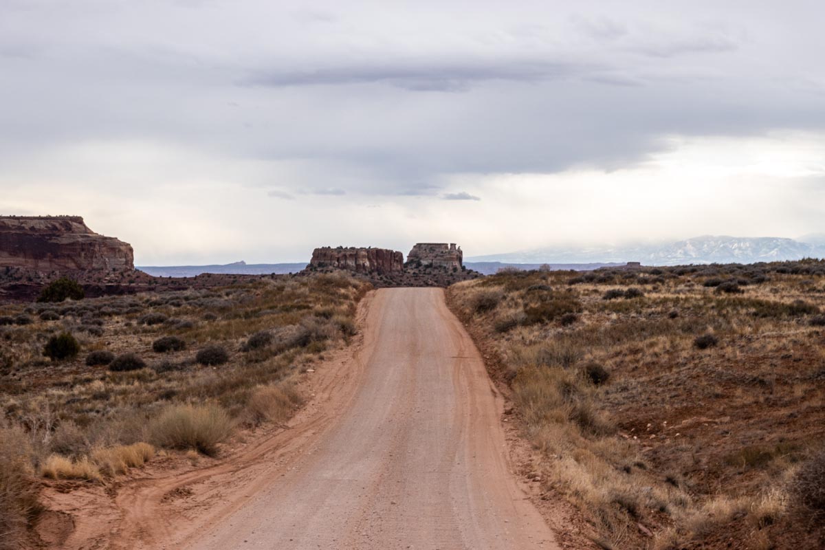
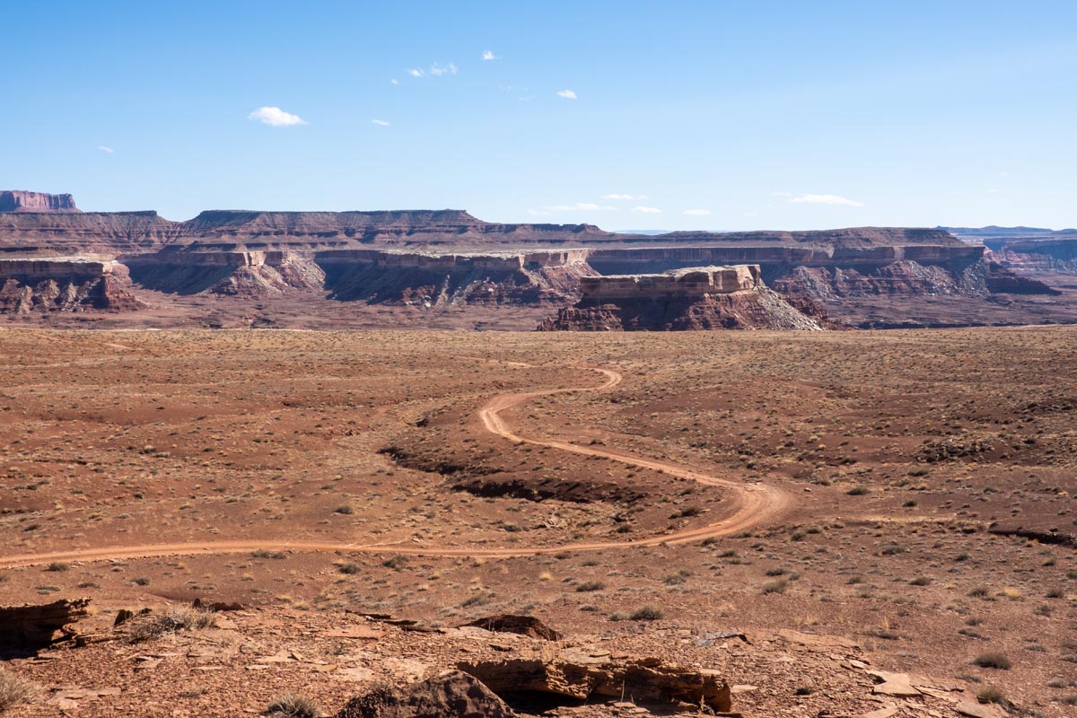
7am came and with it the sun. French toast was pulled from the cooler and drizzled with syrup and peanut butter. I ate caveman style with no fork or plate. My hands were a filthy mix of food and desert dust. I licked my fingers clean. There was nobody there to judge me which was a liberating state of being. It was shorts weather, and knee warmers if for nothing other than to keep the sun off later in the day. Three jersey layers and a vest was too many, but I did it anyway, and then I stopped minutes later to start peeling those layers off. The route I took for White Rim starts at Mineral Bottom because that allows the day to begin with a gradual, 13 mile climb up to the right turn at Road 313 which takes you towards the entrance of Canyonlands National Park. Starting with a gradual, relaxed climb in the morning is a great way to warm up at your own pace compared to immediately bombing down a descent and shivering your way to the bottom. Getting those 1000 vertical feet of climbing out of the way early, while you are fresh, is also a way to avoid having to climb more than is necessary at the end of the day when you are most probably pretty exhausted.
As I turned off the dirt and onto the paved road my pace rose quickly. Paved roads are naturally drop bar bike territory. I had a headwind so I popped lower into the drops and rolled along at around 20mph. It occurred to me that White Rim is not in fact a pure mountain bike ride. Of the entire 100 miles there are probably about 5-10 which are optimized for a true mountain bike. The rest of the miles are either chill dirt or sand doubletrack or they are spent on a paved road such as the one that I was presently on. In that sense choosing the right bike for White Rim is really the act of choosing which part of the route you want to be on the right or wrong bike. I think it could be easily said that for 90 miles of this route a super fat tire drop bar bike is exactly the right bike! But you do pay for that a little bit on those other 10 miles. Is it a worthwhile trade? It was for me, but that differs for everyone.
At mile 21 waits the entrance to Canyonlands National Park. The toll booth was manned and it cost me about $15 to enter on a bike. Also necessary was a face mask as Canyonlands is Federal land and governed by specific mask rules. You don’t have to wear a mask the entire ride, but you are instructed to wear one at developed areas or around crowds. Luckily for me White Rim has pretty much zero developed areas and zero crowds so I was able to breathe freely all day long.
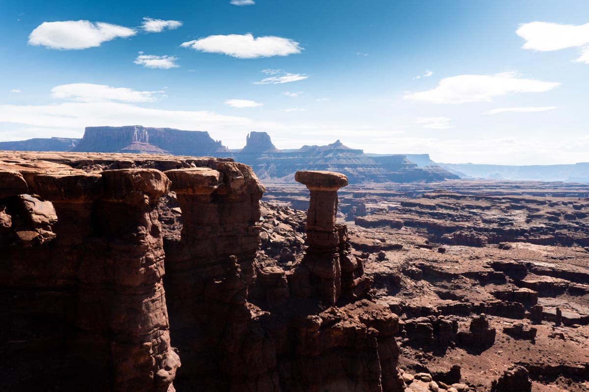
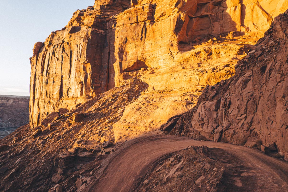
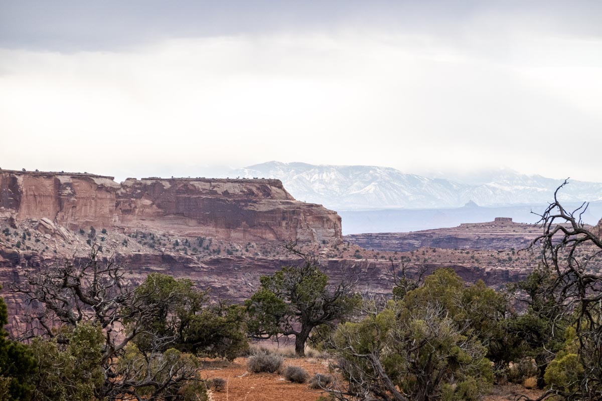
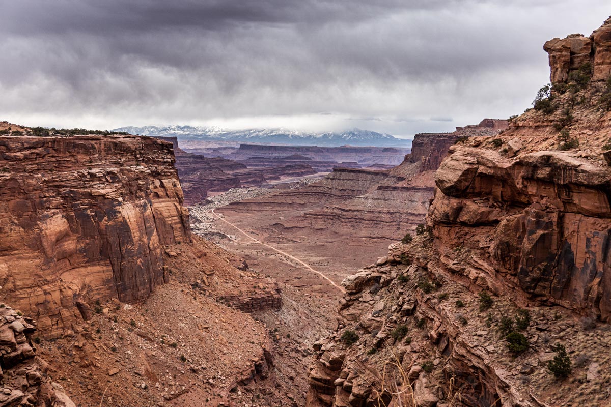
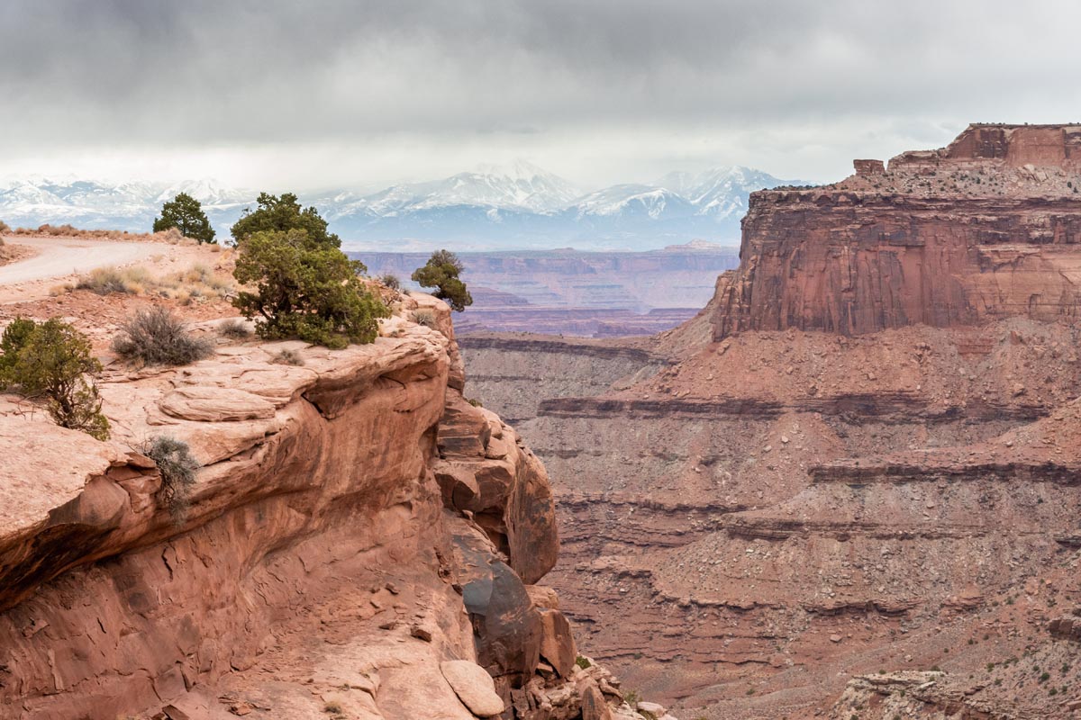
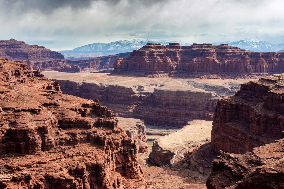
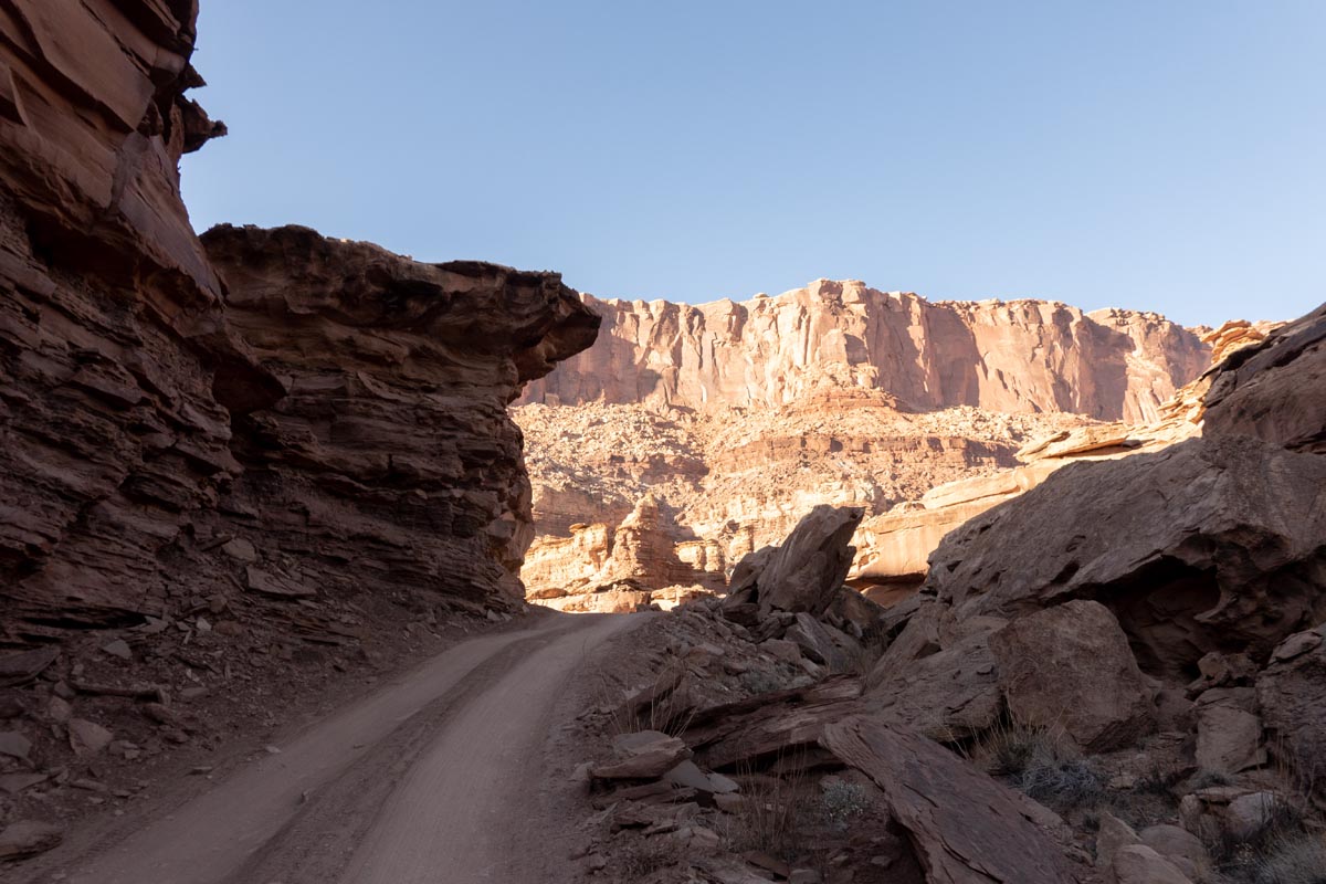
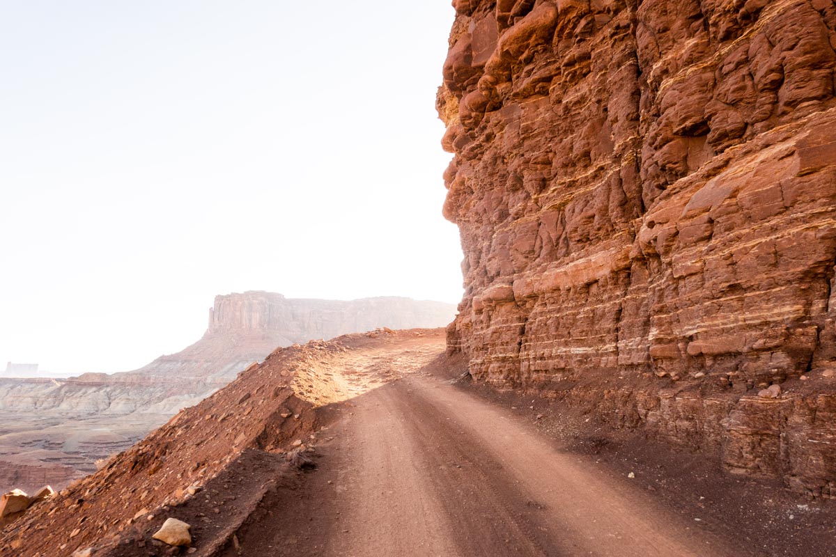
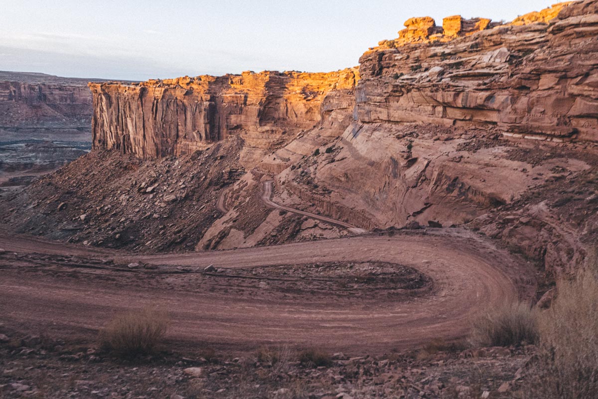
Directly after the park entrance is the left turn on Shafer Trail and the bucket list descent down towards the rim begins immediately. No words truly sum up how awesome the Shafer Trail descent is. As you begin the descent the flat and rolling topography of the first 20 miles of the ride suddenly and dramatically fall away to reveal cliffs and vistas that will take your breath away. There are few places I’ve seen with my own eyes that are as awesome as the Shafer Trail descent and herein exists an essential tension: The dirt road surface itself is quite mellow and non technical. You could rip this descent at a decent clip as no doubt many have. But the faster you descend the faster Shafer is over, and Shafer is incredibly cool to savor slowly and you gawk like a two wheeled tourist at the otherworldly environment that you are plunging into. I stopped at least a dozen times, partly to soak it all up and partly to make a futile effort in documenting just how beautiful the descent is to ride.
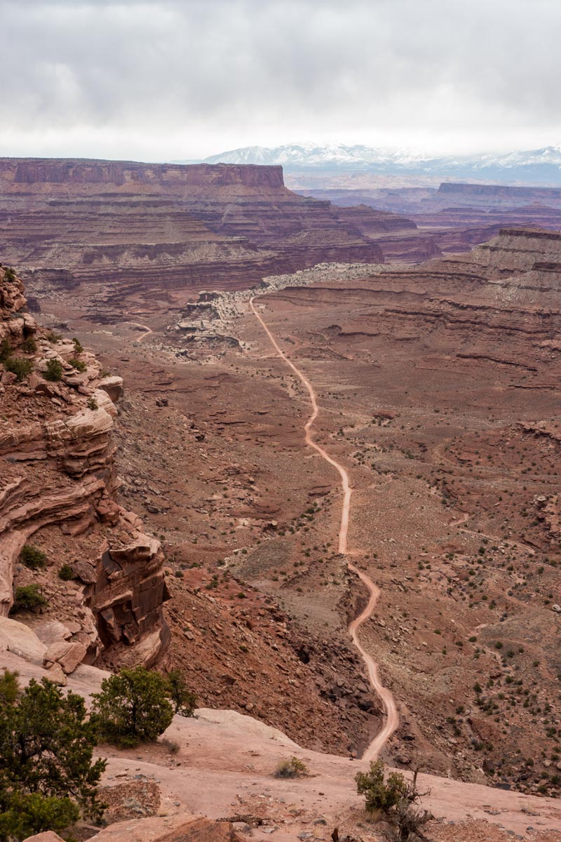
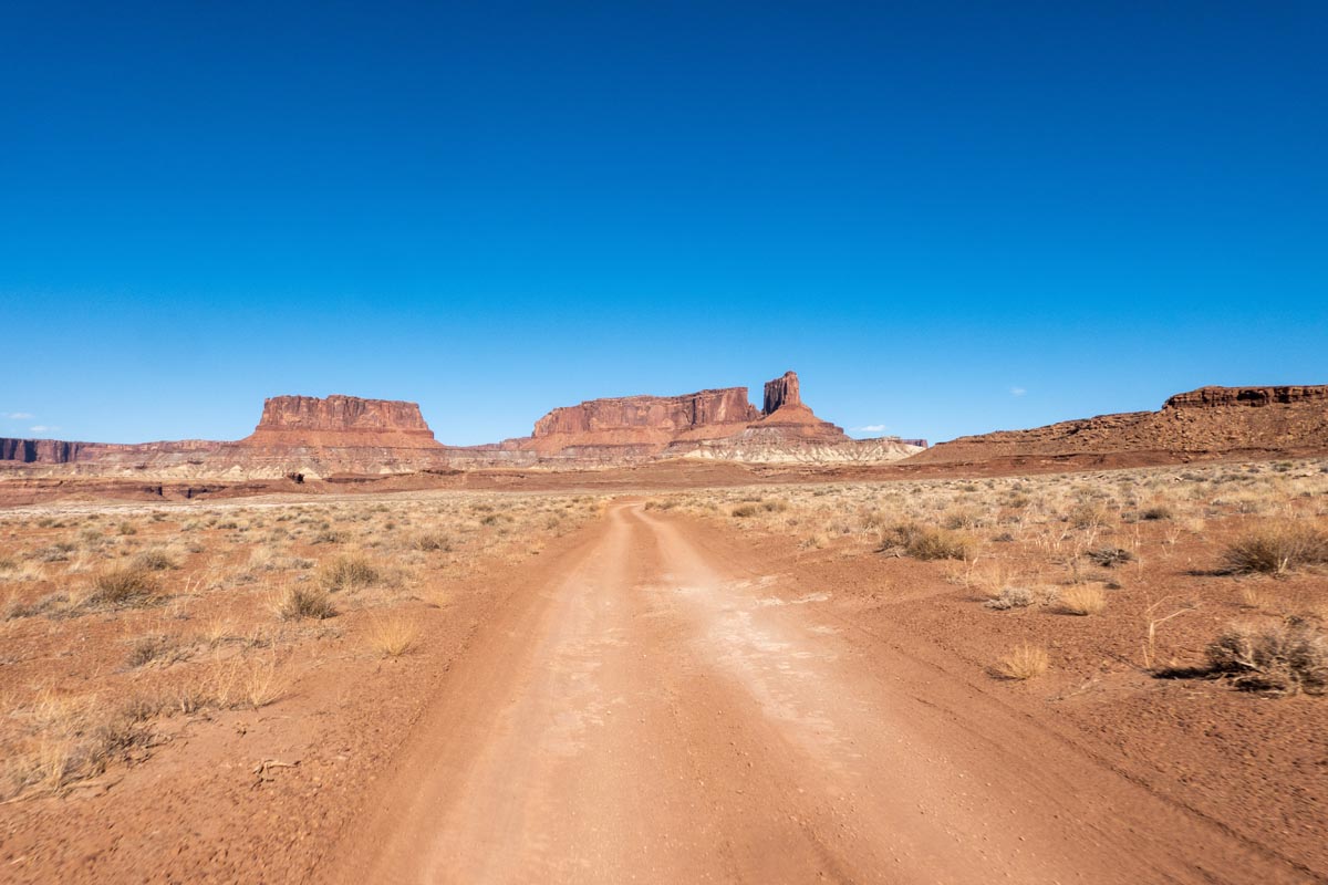
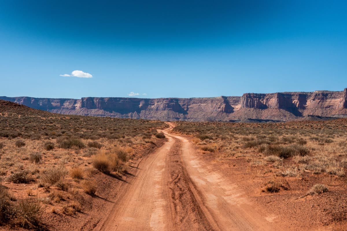
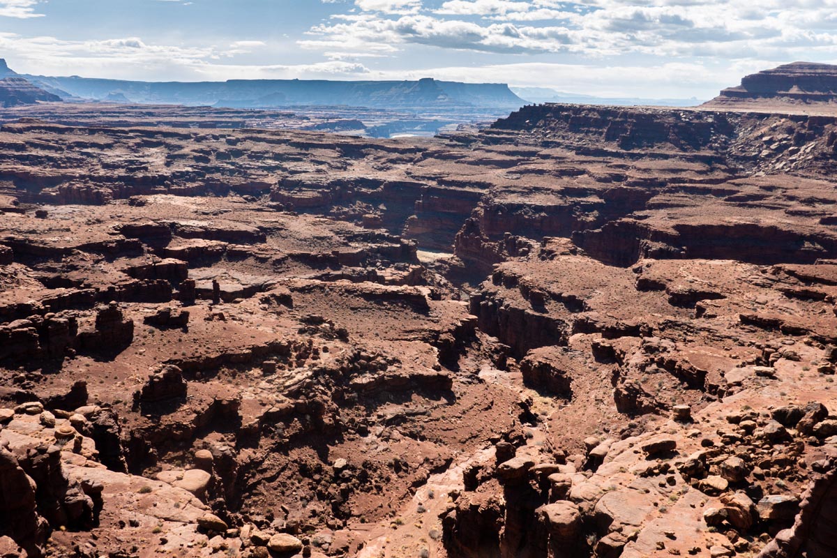
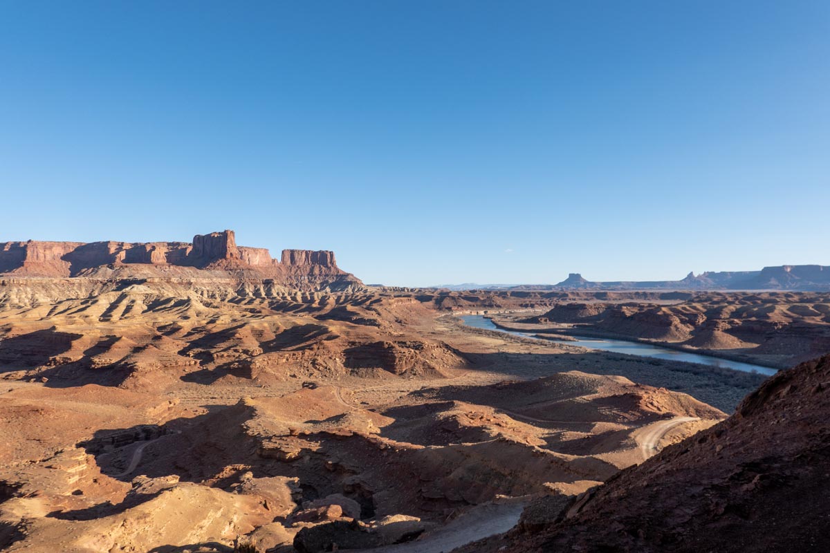
Once at the bottom of the half dozen switchbacks the effortless descending is over and the day’s work beings. You’re at mile 25 and you have 75 miles left to pedal with almost none of those miles being truly downhill. White Rim from here on out lives out the “rim” part of its name and has few notable elevation changes. You do ever so slowly climb at a near constant rate for the next 30 miles but the most climbing that you will detect are a few rollers here and there. It is during these miles that White Rim becomes most contemplative. The doubletrack trail hugs a contorted, eroded plateau of sorts above the confluence of the Colorado River and the seemingly just as large Green River. You are closest to the confluence at about mile 58, but I’m not sure if you ever lay eyes on it far down in the canyon below.
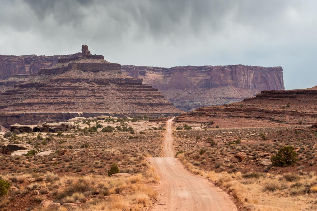

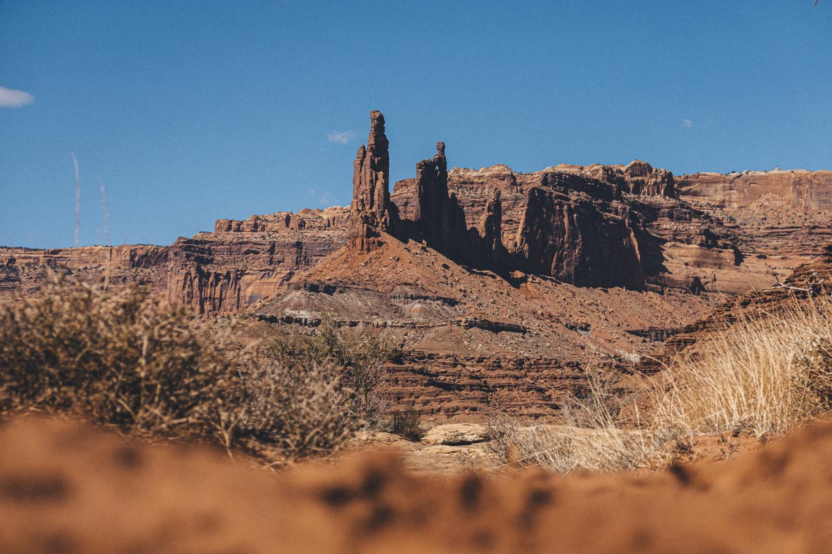
I don’t have a lot to report in these intermittent miles other than being supremely content to be out there riding my bike. The sun came up, the clouds burned off, and the headwind stayed mellow. I wanted for nothing. At times the course is hard packed dirt and sand. At times there are technical sections of sandstone that will require any rigid bike to slow down and pick a line. This technical riding isn’t difficult but it does take concentration and stamina as you have to focus on putting your wheels in the right spot. Muscleman Arch is located at Mile 34 and is 100% worth stopping and walking over to check out. You cannot ride your bike across the arch as tempting as it might be for some crazy people. In 2014 you were allowed to walk across it but in 2021 that is also now disallowed. It is still very worth looking at with your own eyes though. It probably took approximately a Brazillion years to form and will eventually collapse sometime between now and a Brazillion years in the future. I don’t have any photos of the arch for reasons that will become clear later in this story.
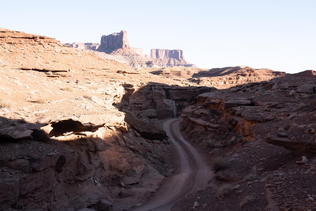
I had it in my mind that the major climb of the day and the lunch spot would both come at about mile 50 but my memory served me poorly and it turns out that the very nasty bump called the Murphy Hogback is not found until about mile 65. In terms of stats the climb is not very long but in terms of viciousness the climb packs quite a punch. The grades vary but hit close 20% at times, and with legs starting to feel the fatigue you may find yourself walking up parts of it unless you bright the right gears and the right fitness. At the top of Murphy’s is a lovely lookout and nearby are camping areas for those lucky enough to score White Rim overnight permits. I rewarded my ascent of the climb with a Coca Cola and half a sub sandwich. The wind was howling up there but that didn’t stop me from sitting on a ledge and staring south into the Maze District of the park. To the west lie Horseshoe Canyon and Dirty Devil wilderness study areas, also known as Mars because the terrain does not seem at all terrestrial.
The descent down the backside of the Murphy Hogback is a short but sweet ripper. I remember it being a bit punishing but in the moment and on the better bike is was merely fun. This is a singular spot on the route where a mountain bike would absolutely slay a rigid bike for speed, comfort, and even safety because a mountain bike will soak up the bumps and track straight and true. I instead kept my hands near the brakes and left a lot of margin of error for myself while I hunted for smooth lines and practiced my body english to finesse the bike down as gracefully as possible. Murphy’s isn’t difficult or dangerous in my opinion, but you could make it dangerous if you were to throw caution to the wind and hot dog it down. There is a time and a place for hot dogs, and that time and place is Coney Island later this summer, not White Rim in March.
After Murphy’s I didn’t know it but I was in for a bit of a treat. The route gradually descends for most of the next 20 miles almost without detection. You can’t let your feet off the pedals and freewheel, but with slight pressure applied to your drivetrain you do move at a nice clip pretty easily, surfing across rock and sand. A small bump of a climb at mile 74 is the only interruption and it is easily dispatched with the granny gear. Enjoy these miles. You’ve earned them.
By this point in the ride I was happy tired. These were the early afternoon miles where the mind was free to leave the body and dream whatever it wanted to dream. In those miles the stress of life melted away for me. There was no inbox, there were no production delays, there was no pandemic, there was nothing but rock, sand, sky, and the rhythm of quads pushing the pedals and turning the crank. These were lovely minutes and hours. These were happy minutes and hours. These moments didn’t need to last forever. I don’t want to be alone or riding my bike all the time. I just want to have moments like this every month or three. Real life is still there but in order to have the sweetness of returning to real life you must first find a way to leave it behind for a spell.
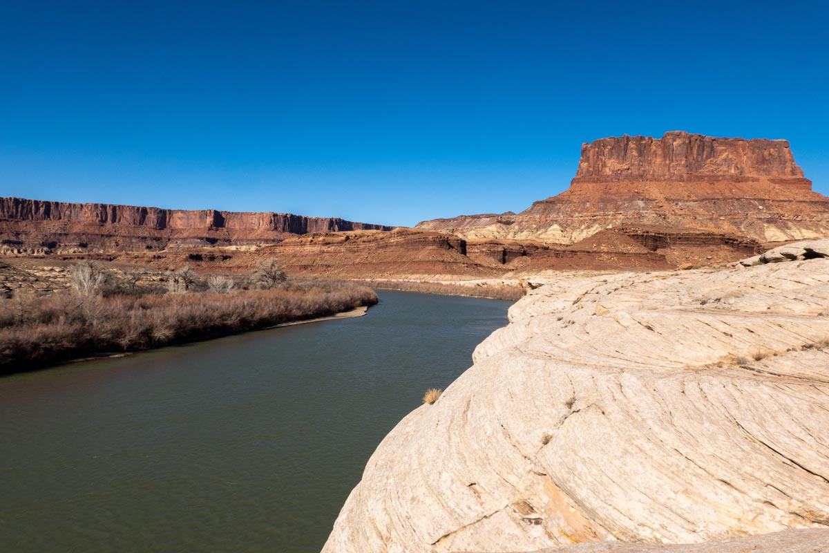
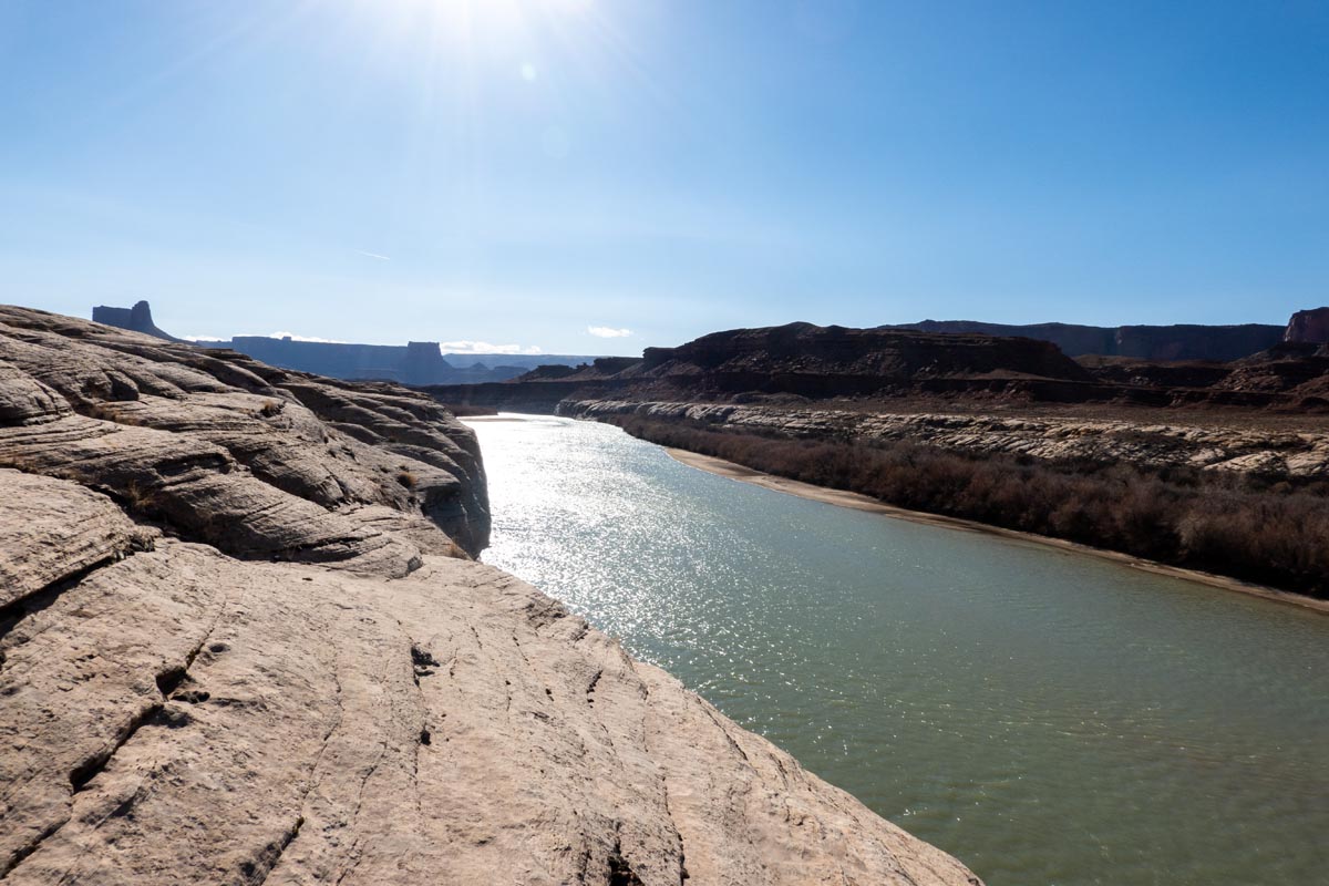
Water ran low. All in all I carried about 170 ounces with me on the ride between four water bottles, two Coke Minis, and two 30oz containers of Powerade. I was by then in the 70-80 mile range and knew that even without a resupply of water I could make it to the end of the ride but without more water those last miles would be quite parched and uncomfortable. I had begun to realize that my elevation was dropping towards the Green River and I started looking for opportunities to refill two bottles. I had a packet of purification tablets with me. Purification tablets taste pretty awful but they do the job in a pinch and weigh nothing so they are always worth having. A hand actuated water filter would be more delicious but it is more gear to carry and I didn’t want to bother with more gear. At mile 85 I made an attempt to skip across the slickrock cliffs and get to the water but the cliff was too steep to descend. A third of a mile later I tried again at a more gradual spot and found the trees on the shore to be an utterly impenetrable thicket. Even 20 feet of tangled trees would have taken hours to force my way through and I would have been bloodied by the endeavour.
Another third of a mile later I arrived at Potato Bottom which features a natural outhouse and parking lot of sorts for the Jeep crowd. I reasoned that anywhere there were Jeeps there would be people more determined than I to get to the river and I was right. I spotted a faint trail into the trees and followed it. The trail got smaller and the branches closed in quickly until eventually I was on my hands and knees crawling in little more than a rabbits tunnel through the sticks. The trail got the job done though and I quickly popped out on a very shallow mud beach on the bank of the Green River. I had found water and quickly filled my bottles. While I was at it I made a little video clip with my phone about refilling bottles from a river that I intended to share later. As I finished up I grabbed the tripod and my phone popped out of it and dropped into the Green with a “plunk”. I stood there in shock for a half second. Brand new iPhone. Green river. “Plunk”.
I tried not to panic. The phone was waterproof. The river was moving slowly but it was utterly opaque. I couldn’t see the phone but it had fallen inches from the bank. It had to be just right there. I kneeled down and reached into the water. The bank fell off sharply for a foot or two and then became deep murky silt. There was no firm bottom. I got more worried. This could be tricky. I thought for a few minutes about options and concluded that I had to go in after it. I couldn’t just leave my phone (and driver’s license and credit cards) in the river. The river was freezing but the air was warm, in the mid ’70s. There was only one option: I stripped own and went in after it. The idea seemed sketchy but there was no river traffic and there was almost no vehicle traffic all day long either. I was completely alone and I had to get my phone back. I grabbed some sturdy branches and tiptoed in up to my chest. My breath was stolen by the cold water. As my body went numb slowly began what I thought was a careful, methodical search of the submerged bank of the river for the phone. It had to be RIGHT THERE. Phones don’t float! But it wasn’t. I couldn’t find it. Minutes passed and I kept working the area. My feet sank into the mud about a foot. I shivered uncontrollably. I would begin to give up and get out and then I would think “I can’t lose this phone” and continue searching. Eventually after about 45 minutes I could take no more. I was frozen, muddy, and getting concerned about the dipping sun. I gave up on the phone and dried off in a bit of a daze. Had taken a bunch of photos and video of the ride that I wanted to share and that was more important to me than the value of the phone. But it was all a loss. I got dressed, grabbed my slightly murky but purified drinking water, and crawled back to my bike. The ride had to continue!
One benefit of a 45 minute ice bath near the end of a hot ride is that you feel pretty amazing on the other side of it. The legs worked great, I had a ton of water, and the miles started ticking by again, albeit in a daze of “I can’t believe my phone is gone, how do I let Sarah know I’m ok? How do I buy gas on the way home?”.
At mile 87 one of the final climbs of the day worth mentioning arrives: Hardscrabble. Hardscrabble isn’t a terrible climb but it also features some steep pitches. You’ll need that granny gear and hopefully you’ve kept topped up on calories because you’ll need them to get over it. My cryotherapy legs didn’t have any issues with Hardscrabble and my mind was still trying to untangle how to contact home and get home so I was distracted. In a way losing the phone stole some of the joy of the final miles of White Rim for me but I did try to make a conscious decision to be pragmatic about it. It’s just a device, a business tool. I could get another phone. I couldn’t get the photos back though. I really like photos. It’s just who I am. There was nobody there to judge me for being shallow.
There are two obstacles left on White rim in the last 10 miles. The first is some sand washes in the road that can reduce your pace to a miserable shuffle. If the sand gets too dry it turns to powder and it will be unrideable. Expect some walking. If you get lucky or ride the route while it is damp or firm from the winter you may have no sand at all, and that is how I found the route when I rode it. I was thankful for this little thing, to be able to ride through the sand traps with little effort.
I passed Labyrinth campground at Mile 93. As luck would have it river access is easy from there. So make a note to yourself: Don’t crawl through a thicket to the Green River, just refill any needed water at mile 93 if you can. Try not to lose your phone if you do.
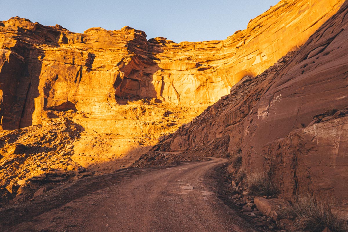
The final climb and final challenge of the White Rim route waits for you at mile 99, it is the somewhat infamous climb up and out of Mineral Bottom back up to your starting point. The climb is no slouch, gaining about 1,200 feet in a mile. Your legs and lungs may hate you on the ascent but give yourself a break, you’ve made it this far and the views on the climb are worth savoring. Because of my Green River swimming escapade I arrived at the climb a bit later than I had hoped but because of that I was able to take it all in at golden hour, just as the sun was dipping into that incredible horizon to the west.
My head peeked over the rim at the top of the climb and my car sat waiting for me just as I had left it. It seemed that once again there was nobody else who had come or gone from that spot while I was away. My sense of solitude was complete. I had had White Rim almost entirely to myself for a day and it felt wonderful. In the car waited bottomless water, Coke, and calories. I had enough spare cash in my backpack to buy gas on the way home if needed. A friendly gas station employee let me borrow his phone and let my wife know that I was indeed fine. By the way is it flattering or sort of a bummer that she wasn’t even worried about be despite not having heard from me for 14 hours? I’ll chose the former.
My 36 hour White Rim adventure was everything I had wanted it to be and I felt incredibly recharged by the experience. Yes the phone thing was a bummer but I’m writing this a couple of weeks later, still grinning from the ride, and right next to my keyboard sits another phone identical to the one I lost. Did I lose some photos and video in the mishap? Yes, but adventures will have mishaps, that’s just the price of admission. Thankfully I brought two other cameras with me on this trip, and those photos and videos are what I’m able to share here in this post. Did I mention I love photos? Don’t judge me.
Postscript notes
Doing any self supported solo ride has an element of danger but White Rim has an extra level of danger because of the utter remoteness of the route. No food resupplies are possible and water resupplies are difficult and not found until the very late stages of the ride. You should balance your water needs with expected temperatures. The hotter it is the more water you should bring. With temps in the 70s fahrenheit I brought about 160 ounces and drank 32oz more from purified river water. Your water needs will vary per pace, fitness, and temperature. There is some 4×4 vehicle traffic on White Rim Trail so be alert.
I carried a Garmin InReach Mini satellite transceiver with me on the ride. This allowed my progress to be tracked by friends / family with the tracking link. There is almost no cell phone reception anywhere on the route so do not rely on your phone for rescue. The InReach has a texting capability and SOS button should rescue be necessary. Also consider evacuation insurance (in Colorado this comes with a fishing license FYI) so that if you do need rescue you won’t be stuck with bills in the many thousands of dollars.
Overnight White Rim tours are easy to book and have the advantage of being guided and supported if you want to move slower and don’t want to carry so much water and food. White Rim camping permits are tougher to obtain but can be had and are required if you want to spend the night out on the route. Camping is only allowed in designated sites along the route of which there are few.
Don’t walk around off the road, rock, or trails, as the extremely fragile ecosystem can be damaged by a single footprint in the cryptobiotic soil layer off-piste.
Gear
- Flaanimal 5.0 Titanium frame / Rodeo Spork 3.0 fork (58cm)
- Arundel Looneybin bottle cages on fork
- 650b Rodeo 2.0 carbon wheels with WTB Trail Boss 2.4″ tires. 19psi (@ 177lb rider weight)
- Redshift Shockstop suspension stem
- Ritchey VentureMax WCS carbon handlebar (44cm)
- Sram Force + Ratio Technology 12 speed mullet conversion. Sram GX Eagle rear mech and cassette. 10-50 cassette
- Easton EC90SL crankset. Absolute Black chainring (40t)
- Selle Repente Quasar saddle / Ritchey WCS aluminum seatpost
- Normal Bicycles white oak bottle cages on main triangle
- Specialized plastic bottle cage under downtube
- Andrew The Maker seat pack and bar bag
- RYLO 360 camera and Sony RX100 VII camera
- 2 x portable mini USB chargers
- 1x USB chargable headlamp
- Quoc x Rodeo Gran Tourer shoes
- RDO LAB Explorts bibshorts
- RDO LAB Jersey / Vest
- Castelli synthetic long sleeve base layer
- Ridge Supply wool socks
Food
- Trailnuggets GO! energy bars
- Snickers bars
- Gummy bears
- Jalapeno chips
- Subway 1′ sandwich (in seat pack)
- GU gel
- 2 Coca Cola Minis
- 1 Banana
- Nuun hydration tablets
- Skratch Labs in one bottle
- Powerade in two bottles
7 Comments
Bravo, Stephen! Such a great read. Love the shared knowledge, the introspection, but not the iPhone debacle. I cried for you and could very much relate.
Thanks for the tears and the kind words Pete!
Great writing and amazing adventure. The introspection in all of your posts inspires me.
I’ve done the reverse route on my dirt bike. I’m a road cyclist. Having recently purchased an Otso Waheela C, I’m planning some White Rim excursions on the Otso. I’m using this write-up (with your gear and tire size choices) to get a feel for what gearing I should experiment with on some 15% to 20% grades (before riding all the way out to Murphy Hogback or Hardscrabble Hill). Thanks for the post! The video is cool, too!
I feel like a 40×10-50 would be ideal for a strong rider. I did it this week again on 44×10-50 and it was tough to make it up Murphy’s and Harscrabble. With a 38 up front or a 10-52 in back you’d be in a much better spot for spinning up steep climbs and could still pedal and make nice time on the fast / road sections of the route. Enjoy the ride!
Thanks for this write-up – I read it about 12 months ago and after an attempt to coordinate a group to do this last October which didn’t work out, a group of four of us did it this week. It was amazing and a definite bucket list ride.
Great write up! I’ve wanted to do this route since the first time I visited Moab in 1992. Finally gonna get it done this spring on my Cutthroat. Thanks for all the info here, it’s super helpful and inspiring.