
Preface
I’ve been on a long-distance off-road adventure kick the last few yeas (exhibit A, exhibit B,exhibit C, etc). When I heard about the Rockstar VA bikepacking race, I decided not only did I have to ride it, I was all-in it to win it. The course seemed to be right up my alley: long backcountry trails, rocks, ridge, suffering, hardship, or other words everything that makes an epic event. At first I thought “hey it’s just a really long ride” but the more I dove into it I found it’s actually a whole different sport. It’s actually a combination of land navigation, lightweight camping, nutrition planning, time management, hiking, and with some bike riding in there as well.
In a bikepacking race, the course is provided as a GPX file–there are no physical course markings, volunteers giving directions, etc. You bring your own navigational equipment and figure out how to stay on course. I’d also have to be self-sufficient. Not only would I have to be prepared to sleep along the trail, I’d be responsible for providing my own food and hydration along the way–no aid stations or caches allowed–and I’d have to be able to fix any mechanical issues I might encounter. For safety, each racer would be required to carry a Spot satellite tracker, so our loved ones could kep tabs on our progress while we were isolated from cellphones and the internet.
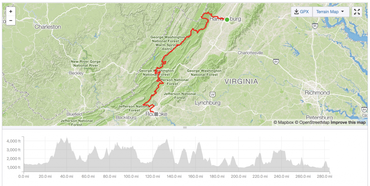
There were three categories with their own routes for the race: a Trail route, composed of mostly off-road hiking and mountain bike trails, a Gravel route, composed mostly of dirt roads, and a Ranodnee route which was all paved. All three shared some common sections, and all three would have a “Grand Depart” from Harrisonburg. There was a also an Individual Time Trial (ITT) option for those who wished to complete at their own pace. I, of course, chose to do the Trail version with the Grand Depart. Long, hard, remote…sounds like a challenge!
Act I: Throes
A few weeks prior to the race the weather forecasts started showing the threat of wet weather. First rain on the Grand Depart. Then flurries. Then 5-9″ snow. Chaos and speculation reigned on the discussion forums. A few riders, trying to get ahead of the impending weather, decided to change their Grand Departs last minute into Individual Time Trials that left on Thursday or Friday. I hesitantly watched the weather yo-yo between rain and snow. I decided I had too much invested to change course, and would start the race on Saturday regardless of conditions…how far I got would depend on the weather.
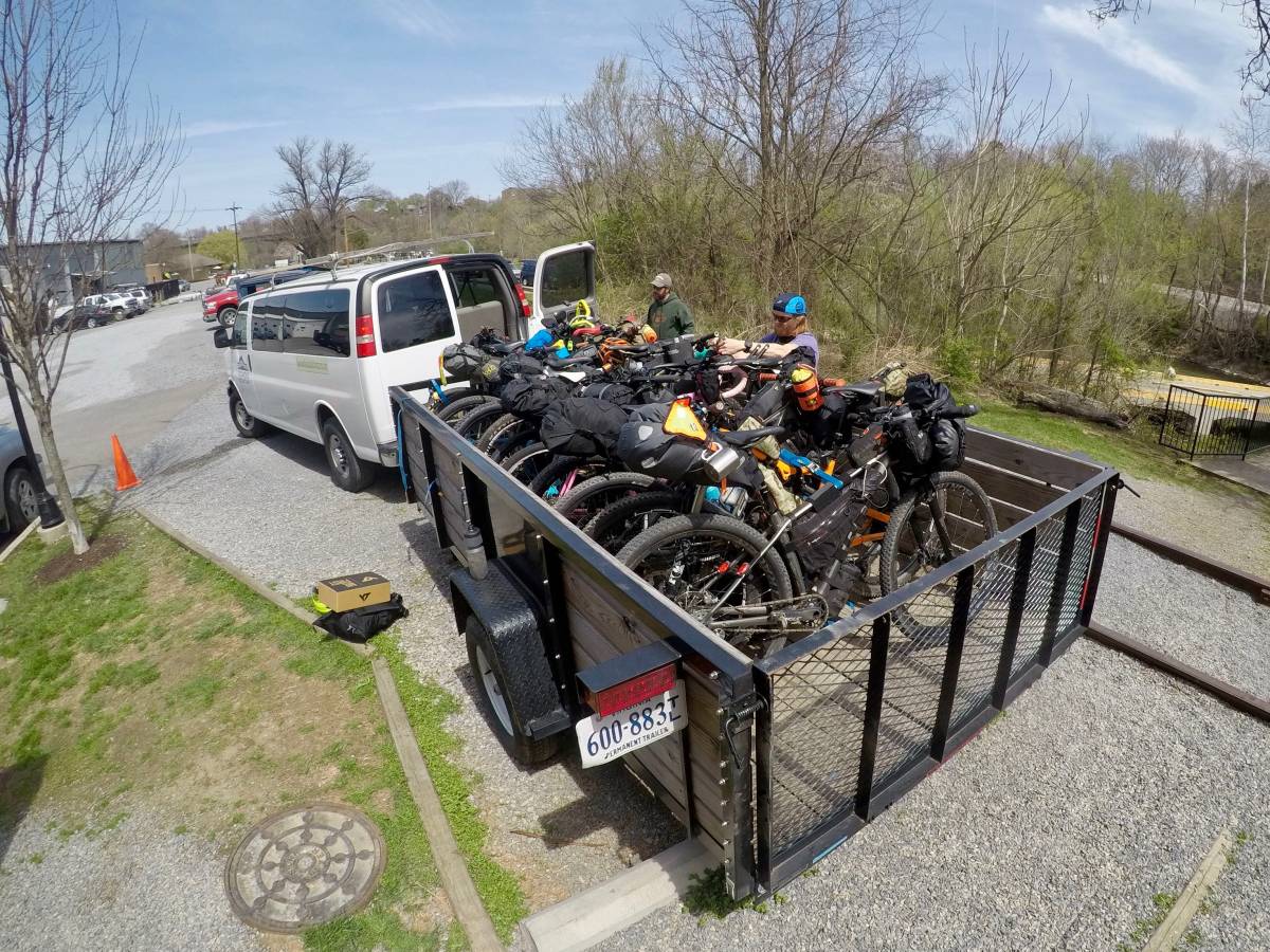
My first logistical challenge was figuring out how to get to the start of the race, and then back home again from the finish. Although she offered, I didn’t want to make my dear wife drive back and forth and wait while I spent who knows how many days on the trail. Fortunately, Roanoke Mountain Adventures offered a shuttle service from Roanoke back to Harrisonburg the day prior. This way I could race at my own pace and have my car and clean clothes waiting for me at the finish. So on Friday morning I made the three-hour drive south, and piled into a 12-pack van with a dozen of my newest friends and more gear than a small bicycle shop.
The next challenge was where to stay in Harrisonburg the night before the race. My initial plan was to camp in Matt H’s backyard in Harrisonburg, but with a strong chance of rain I figured it would be a drag to start the race already wet, and went in search for a cheap hotel. Serendipitously Mike C. had an extra bed at the Super 8 and offered to share. After a leisurely dinner at Rubys Arcade we crashed for the night and prayed for a dry start the next day.
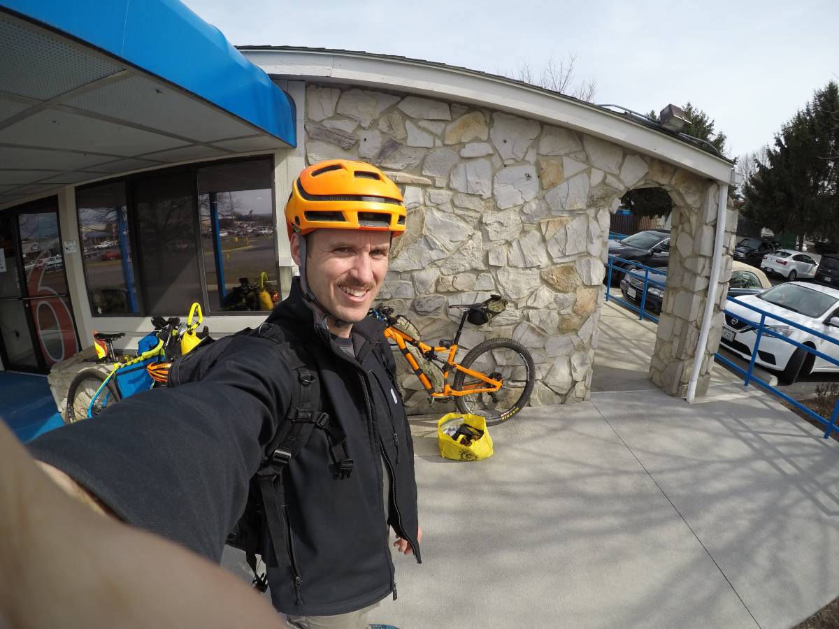
We woke a few hours before sunrise and behold, 50% chain of rain had turned to 0%. There was a slight chance of snow flurries later in the day, but less than an inch accumulation forecast. Maybe good things do come to those who wait?
Around 0600 riders started straggling into Black Sheep Coffee for the grand depart. It was quite the sight to behold–road bikes, gravel bikes, mountain bikes, fat bikes with riders of all ages, shapes and sizes. Rob I., the “promoter”, gave his last race guidance and at the stroke of 0700 gave the “go”. The race was on.
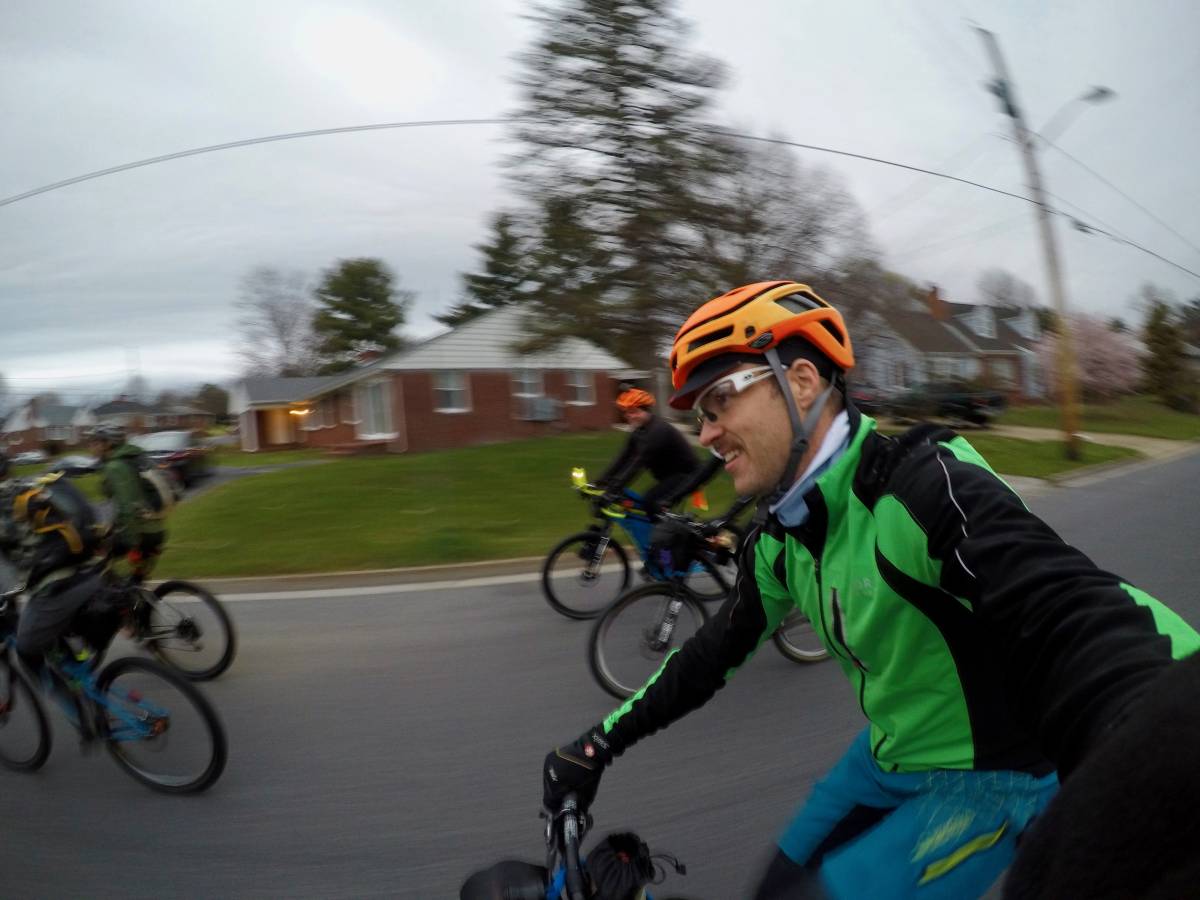
Our motley trail group rolled west towards the hills, first taking a short jaunt through the local trails in Hillandale Park. I made sure to stay near the front with those I thought would best match my desired pace. The pump track was a good place to learn just how far my dropper could go before buzzing my rear tire.
The winds were favorable as we sped towards the hills, and I soon found myself in a small group with just Britt M. and Chris M. rolling along at a good clip. I was surprised at the amount of climbing it took to reach the mountains along the country farm roads and chicken farms.
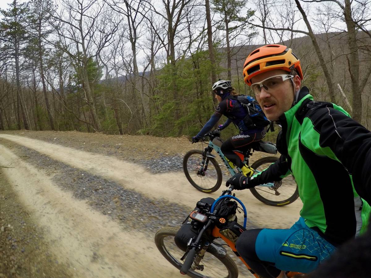
Britt was riding the strongest of our group, and kept the pace high as we entered the National Forest and climbed our way towards Flagpole Knob. Along the way we caught and passed several groups of gravel racers, who not having to ride the single track at Hillandale had gotten ahead in the early miles.
The roads gradually changed from pavement to gravel to double track and then finally jeep road. Several pitches near the top grew too steep to pedal our loaded biked and we had to resort to pushing–a theme that would occur more than once on this journey. Near the top Britt and Chris opened a gap on me, and not wanting to dig too deep this early in the race I eased up and watched them slowly roll away. I wasn’t too worried, as I knew there was a significant amount of descending to come, and hoped I could catch back after a brief recovery.
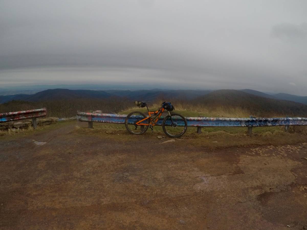
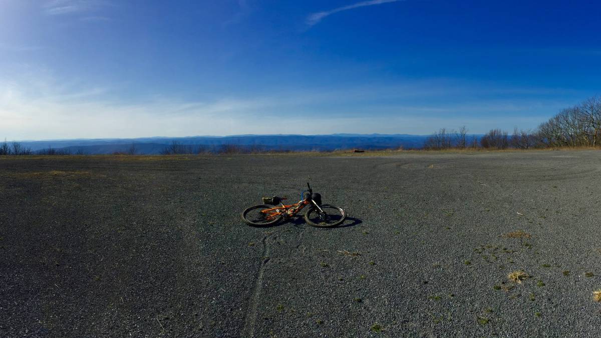
The dirt changed to pavement at Reddish Knob road, and still solo I pressed onwards as the temperature dropped and the clouds moved in. The route had us summit Reddish, then back-track slightly to descend down Timber Ridge. Just as I approached the summit on the way up, I saw Britt and Chris returning from the summit headed down the trail. I figured it would be poor form to jump on Chris’ wheel without reaching the summit, so I again watched them ride away and headed for the top. But at least I knew the gap. The winds were calm but something was obviously brewing in the distance. After a quick photo and snack, I head back downhill and let it hang out on Timber Ridge hoping for an intercept. My efforts paid off, and within a few minutes the three of us were back together.
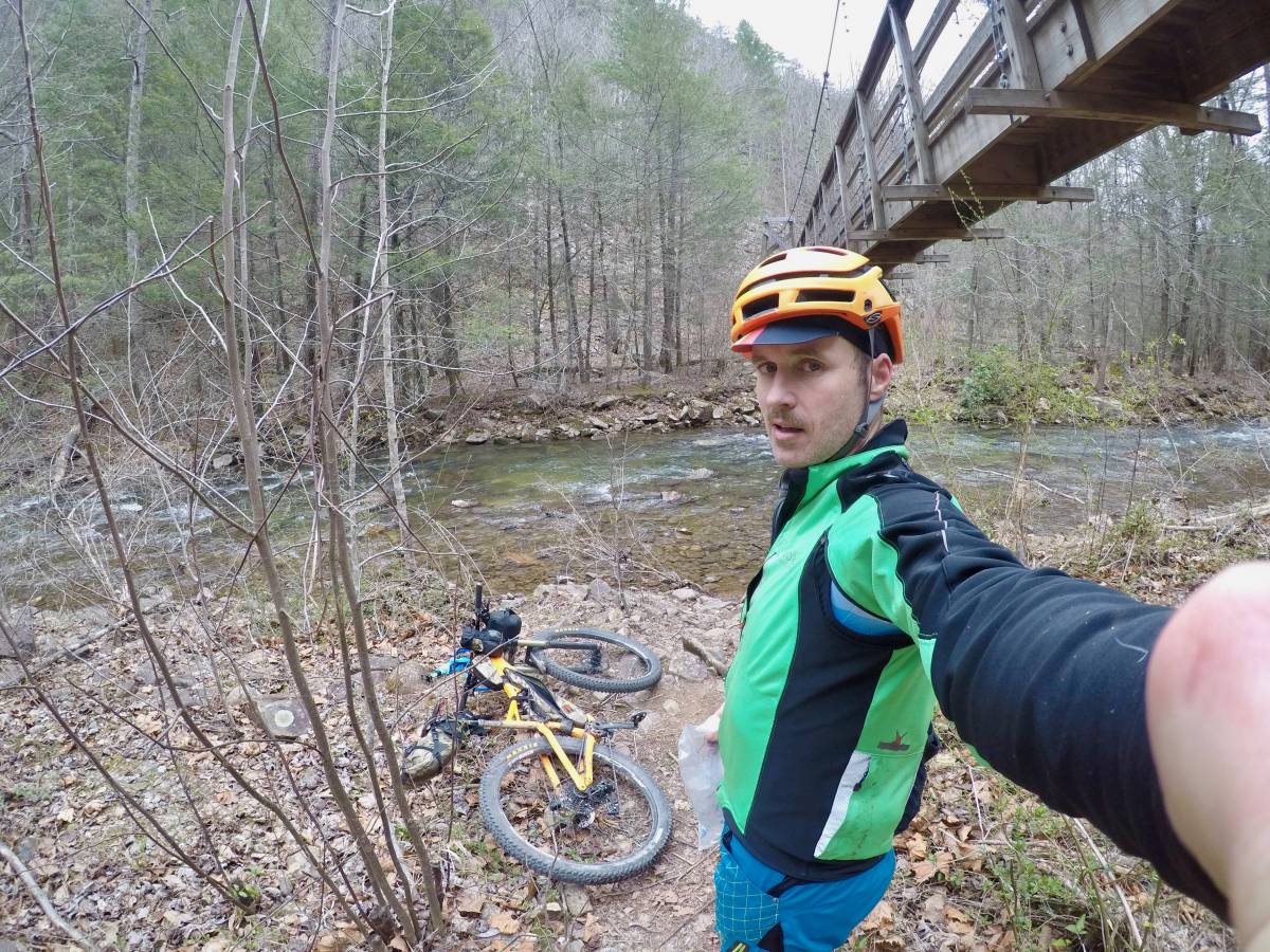
The three of us stayed together down Timber and Wolf Ridge, then back up Narrowback and down Tillman West for some rowdy fun. By this time we were about 5 hours in , and when we reached the bridge to Lookout, I was just about out of water. Britt and Chris, their Camelbaks still full, pressed on up Lookout but I stopped to fill up in the North River. I hoped I’d see them again.
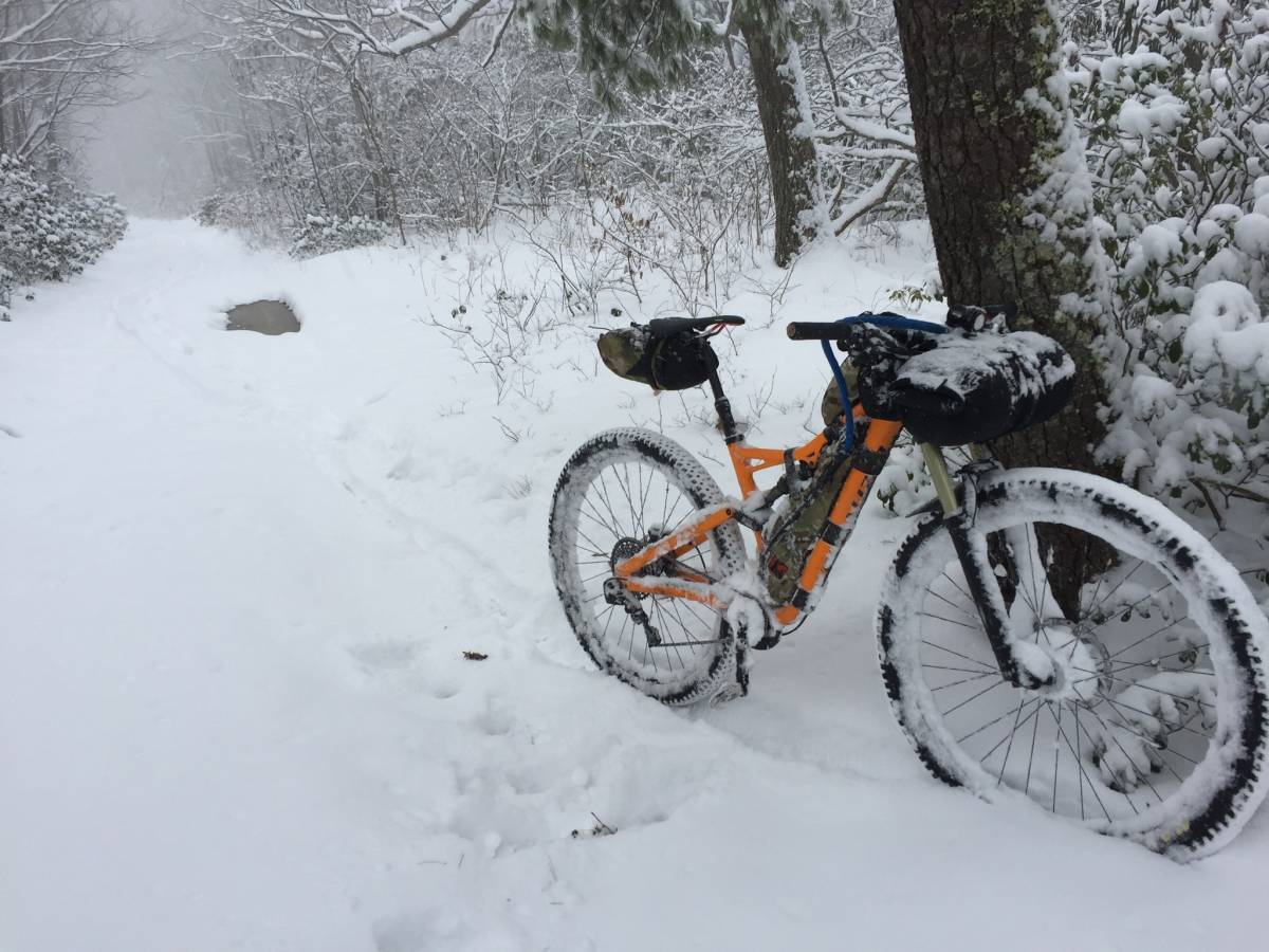
About half way up Lookout I noticed a few flakes falling, and within minutes it was full-on snowing.
The snow added an extra challenge on Lookout’s rocks, and soon the ground was covered. Riding up Hankey Mountain the accumulation increased, and I could see two pairs of tire tracks ahead of me. As I grinded up the climb I tried to figure out how long the tracks had been there based on how much snow there was covering them. A few times I convinced myself they were just over the hill. But other times the gap appeared to be increasing with time.
By the top of Hankey Mountain everything was covered in snow, and the ripping descent down Dowell’s Draft was wet and treacherous. I knew this was my chance to make up some time on the leaders so I let it all hang out. Turns out a 50-lb bike goes downhill pretty quick, even in the snow. My perseverance paid off and just before the bottom of the climb I again made contact, and the three of us rolled into West Augusta for visit to the Country Store.
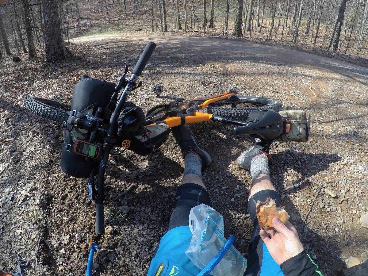
Bikepacking rules state any assistance along the course must be available to all racers, so while having someone meet you with supplies is off-limits, visiting public stores is almost a necessity. In West Augusta we piled our cold and wet bodies into the small cafe and ate ravenously, peeling off wet layers and doing calisthenics to restore circulation. I downed a cheeseburger in record time. Soon gravel racers started dripping in, our routes again converging in the deteriorating weather.
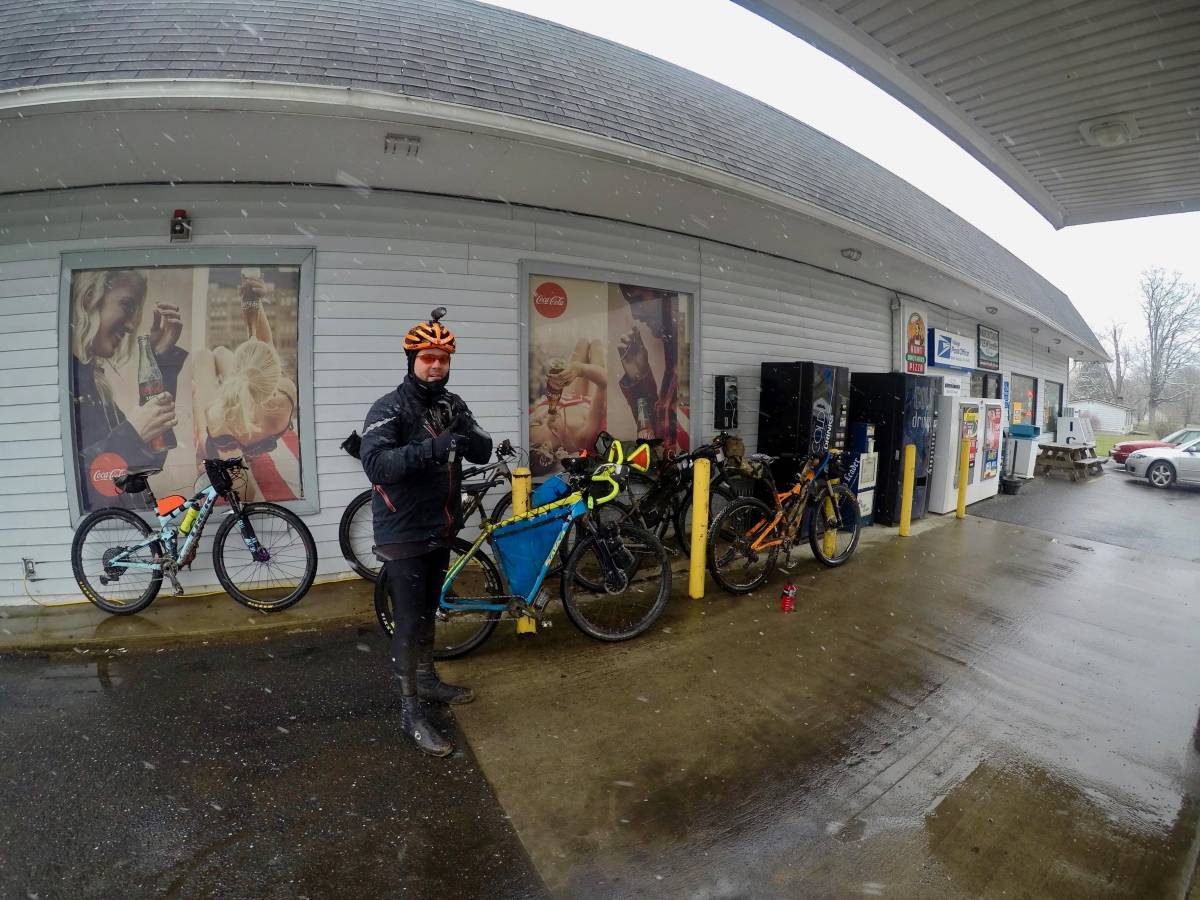
At one point there were probably a dozen wet and tired racers huddled in the cafe. The weather report called for more snow until nightfall, with overnight temperatures in the 20s, but likely teens at elevation. This was the first major crux of the race for the trail racers–many were not prepared to spend overnight in the wet conditions and were forced to switch to the gravel route which at least offered a chance to skirt civilization. I felt confident in my gear and ability, and after a quick change of clothes headed back out into the weather, towards Brayley’s Pond, as the snow continued to fall.
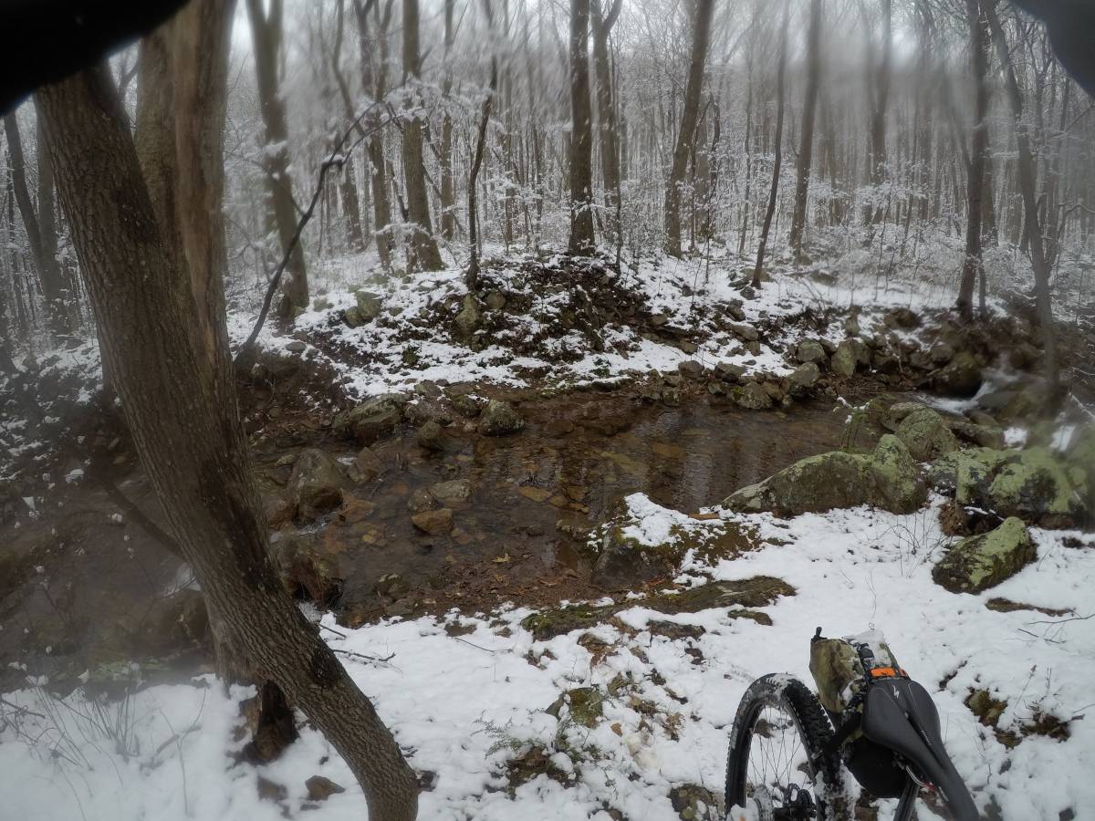
The trails up Brayleys and Road Hollow were better than expected, and as I climbed in elevation the snow changed from large wet flakes to smaller dry ones. My gear kept me dry, and the snow didn’t stick well to the shale trails making riding possible.
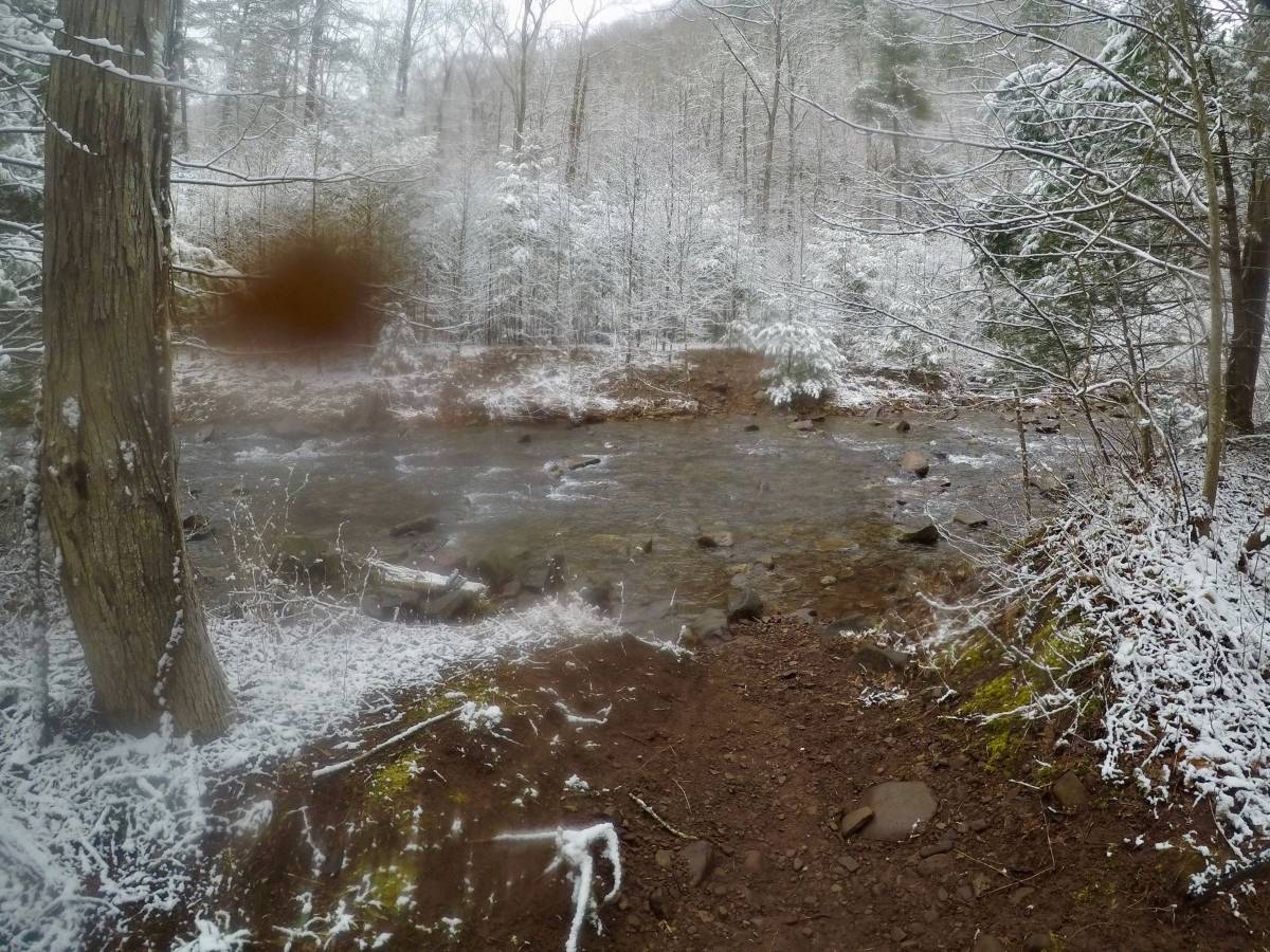
The biggest challenge on this stretch was getting across the roaring creek at the bottom of Road Hollow. It took me a good 20 minutes to figure out a way across without getting my feet wetter than they already were. In the end I stacked a bunch of rocks and leapt acrosss, just barely splashing my right foot.
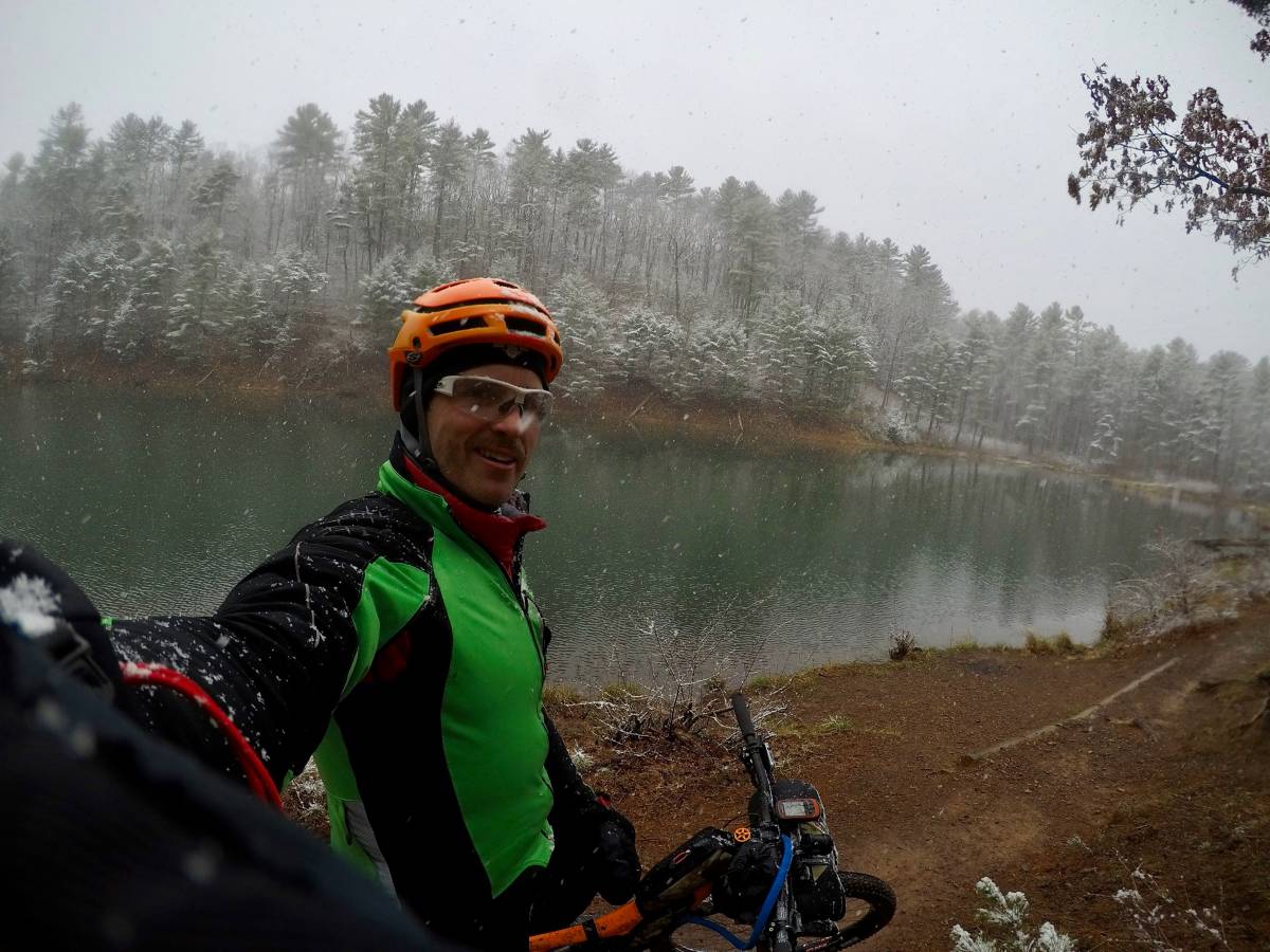
I reached the Shenandoah Mountain Trail and pulled up to the Confederate Breastworks just as the sun was setting over West Virginia mountains in the distance. The snow had stopped falling, but there was 1-2 inches on the trail and roads. I was feeling pretty good.
At this point the trail route converged with the gravel route along the SMT, and I caught a few gravel riders grinding along uphill in the snow. I knew from Trackleaders that my friend Joe K., who had started a solo ITT the day prior, was just a few miles ahead of me. And as I turned off the SMT on to the Southern Traverse I found his tracks and decided I’d ride until I found him that night.
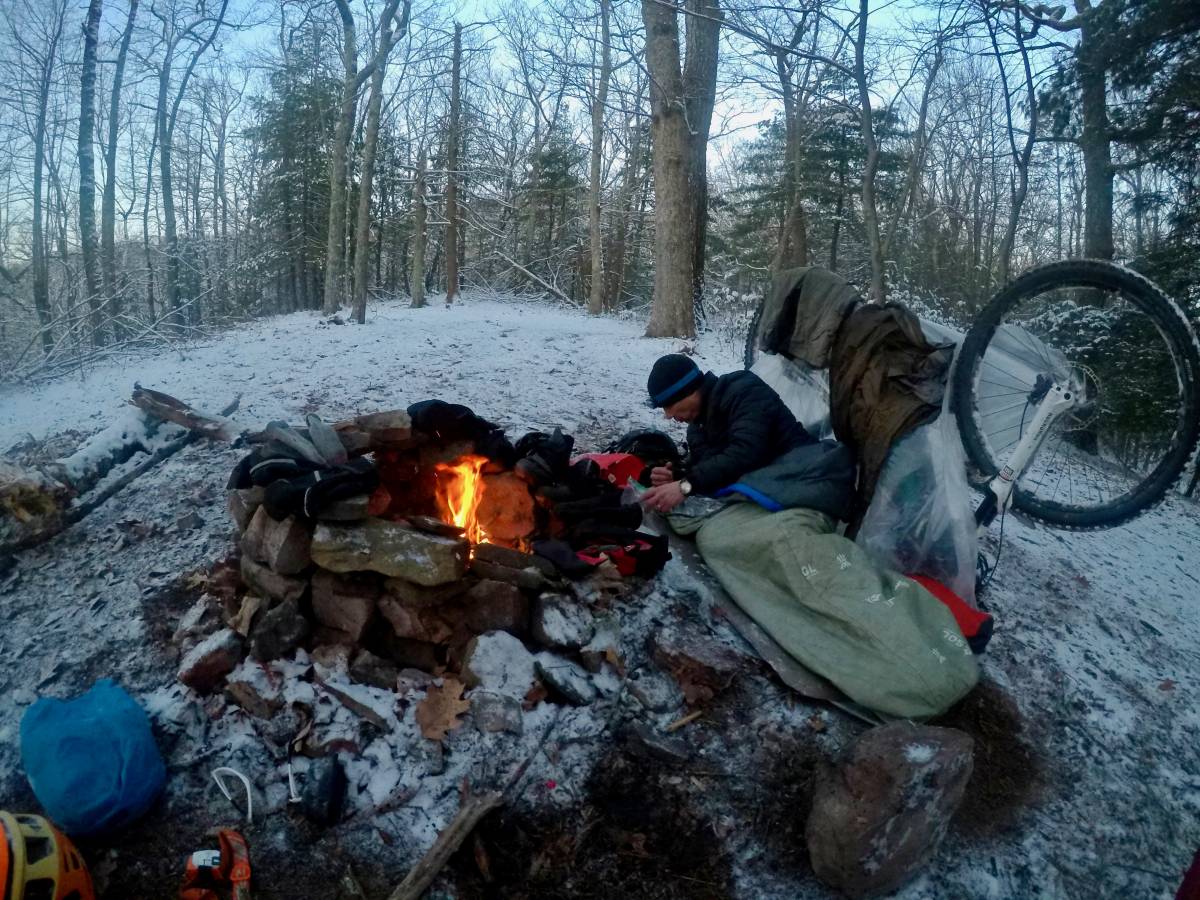
The snow made up hill progress slow, but after about an hours ride I came across him camped near a fire pit just settling down, and I joined him for the night.
Day 1 progress: 16.5 hours and 90 miles.
Act II: Forgiveness
The night on the ridge was cold and breezy, but I managed to get a few hours sleep. Just before sunrise we made the fire again and thawed our frozen gear (and might have singed a few articles of clothing as well). The sky was clear and we welcomed the warmth of the sun as it rose above the mountains to the east. Today’s first task was the Southern Traverse–a 15 mile single track that never really climbs nor descends as it winds between the ridges on the SMT. The snow was about 2″ deep but light enough not to impede progress.
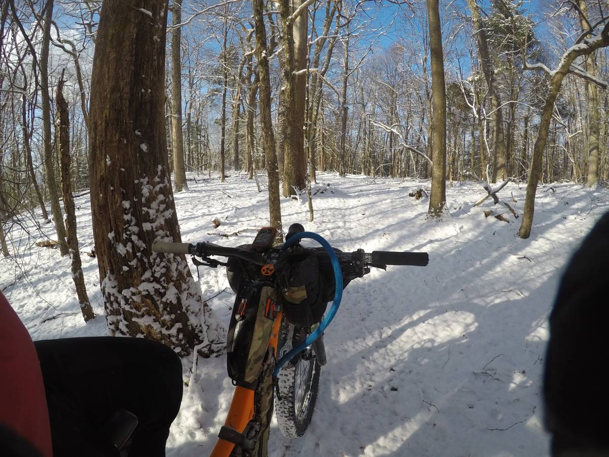
Joe and I set into our own paces, and by mid-morning the sun had melted most of the snow on the south-facing slopes. When I reached the end of the trail the snow was gone, and the temperatures had climbed into the low 50’s. A quick stop for a snack and a water re-fill, and I was off on a short road transfer towards the next trail section.
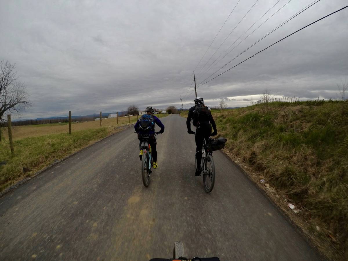
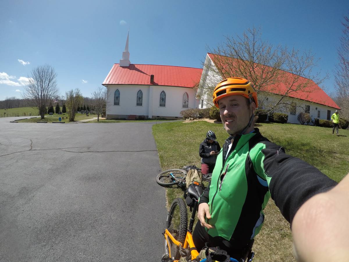
As I left Fort Lewis I caught up to AJ and Rick who were on the gravel route. We enjoyed some miles together and shared stories of our evenings in the snow. When we stopped to grab some water from a local church I was more than tempted to take a nap in the sun.
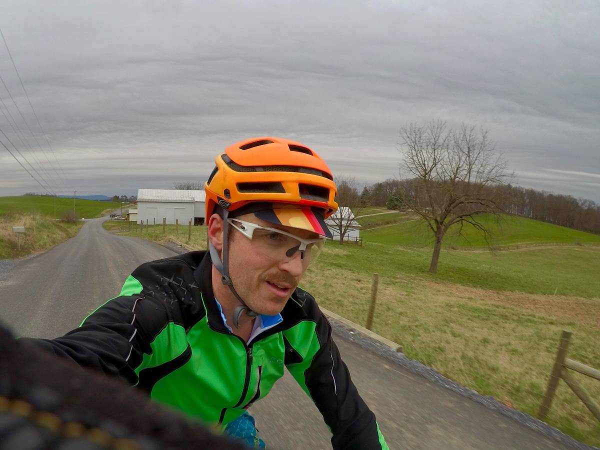
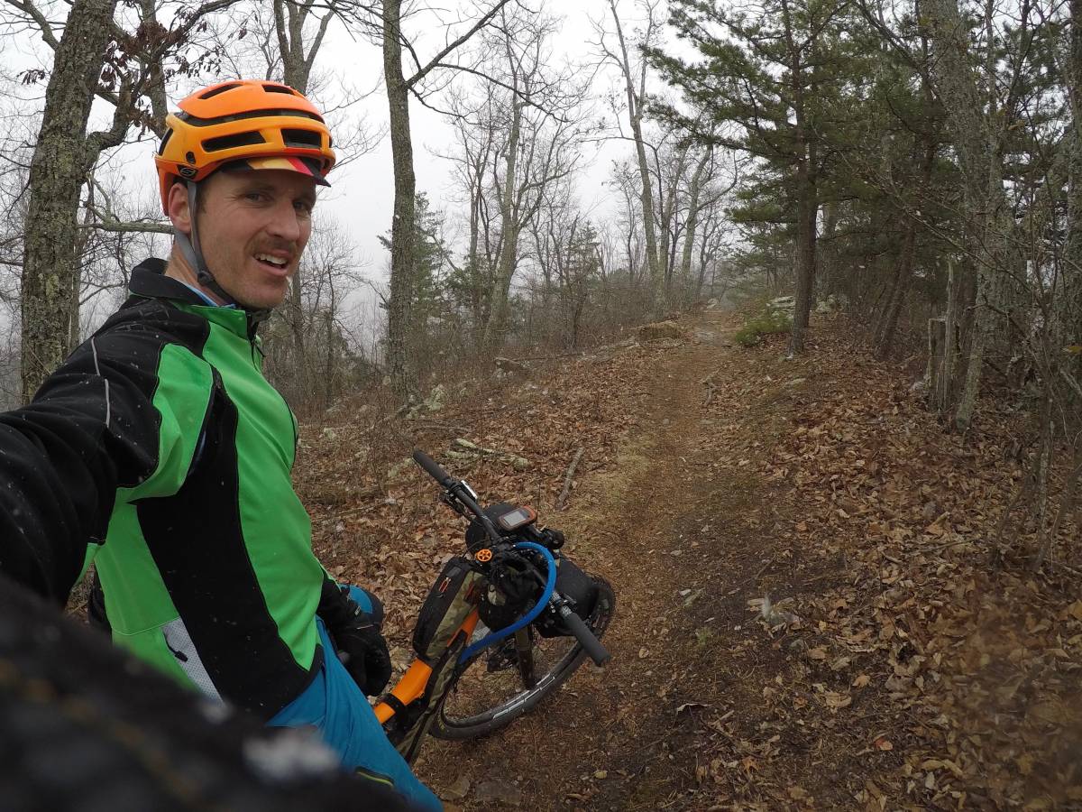
Within a few miles our paths once again diverged, and as they headed south towards Douthat State Park I hooked slightly west for a pull up Little Mare Mountain. In comparison with the managed and maintained trails of the Harrisonburg network, riders on Little Mare quickly find themselves in the rough and rugged Virginia backcountry. The trails were more narrow, more overgrown, and more steep than anything ridden so far. All traces of snow were completely gone, and the dry leaves sometimes made ascending hard. The long grind up the ridge seemed like it would never end, but finally I reached the finish near the conservancy lodge and transitioned to several miles of damp gravel roads, still climbing in elevation.
The views from the ridge were spectacular, and it felt like I was on the moon as I rode past Ingalls Airport–the highest public airport east of the Mississippi.
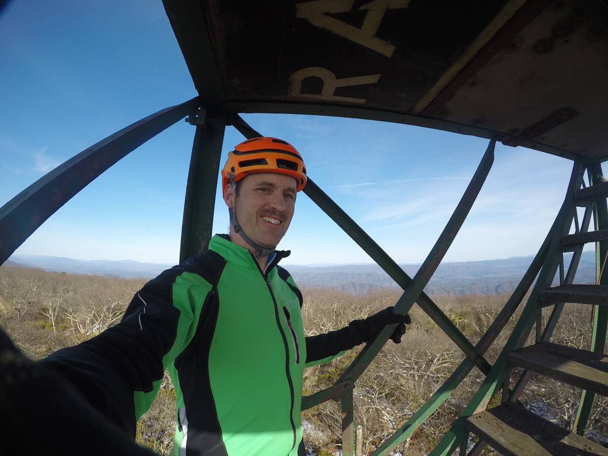
And how could I skip a quick trip up the fire tower on Bald Knob?
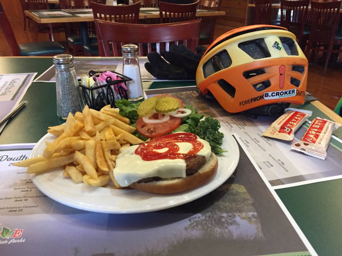
After what felt like climbing all day, I made the ripping descent down Sandy Gap, hiked over Middle Mountain, and reached civilization at Douthat State Park just as the sun was setting. The park restaurant was open another 45 minutes, so I took the opportunity to eat another cheeseburger and warm up by the fire before they kicked me out.
Becasue I was feeling pretty good and the weather was still mild, I made the decision to make the push out of the park and get in more miles before calling it a night. Middle Mountain was in pretty good shape being recently brushed, and in a few hours I dropped down to Sulpher Springs Rd at the bottom of Fore Mountain. There wasn’t a campsite per say, but a gravel parking lot that I was able to camp hobo-style behind some boulders. I even made a small fire before falling into a dreamless sleep, hoping for another good day.
Day 2 progress: 14.5 hours moving, 155 miles complete.
Act III: Regret
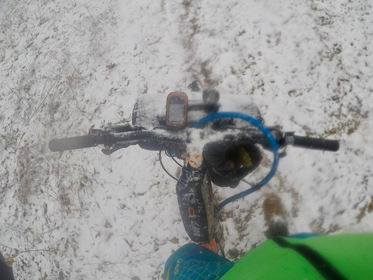
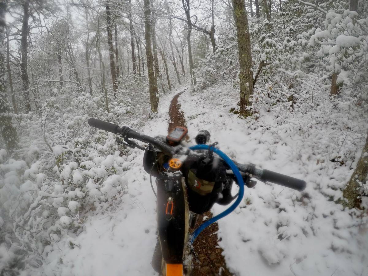
Around 0430 I woke up lying on my back in my bivvy. I did a quick inventory of how I felt, and was pretty happy. I was dry, I was comfortable, my feet were warm, and life was good. And then I felt something on my face. At first I tried to convince myself it was just dew falling, but when I switched on my headlamp I discovered what I really feared…snow. And then it picked up fast. Not wanting to compromise my dry sleep gear, I quickly packed up and headed out on the bike towards the next major town–Covington. I didn’t know the forecast, but the trailhead sign said “SR-60 10 miles” which meant I should be able to find warmth and shelter in a reasonable amount of time. What I failed to understand was the course didn’t take the 10-mile route–it would be more like 20 miles, but due to the amount of snow falling it would take me the rest of day to reach Covington.
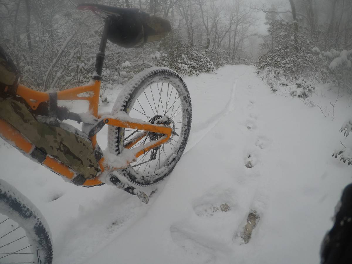
By sunrise, the snow was falling about an inch an hour, and the snow rapidly became far to deep to pedal through. Still thinking Covington was just over the mountain I soldiered on uphill, sometimes kick-pushing down when able. Mentally I struggled to continue, and questioned my ability to finish the race if they conditions held.
The first miles over Fore Mountain were relatively non-technical and would have been easy climbs without the snow, but once I crested the summit the trail too a dramatic turn into the rock-strewn Dry Creek Trail, and then the narrow and windy Peter’s Ridge.
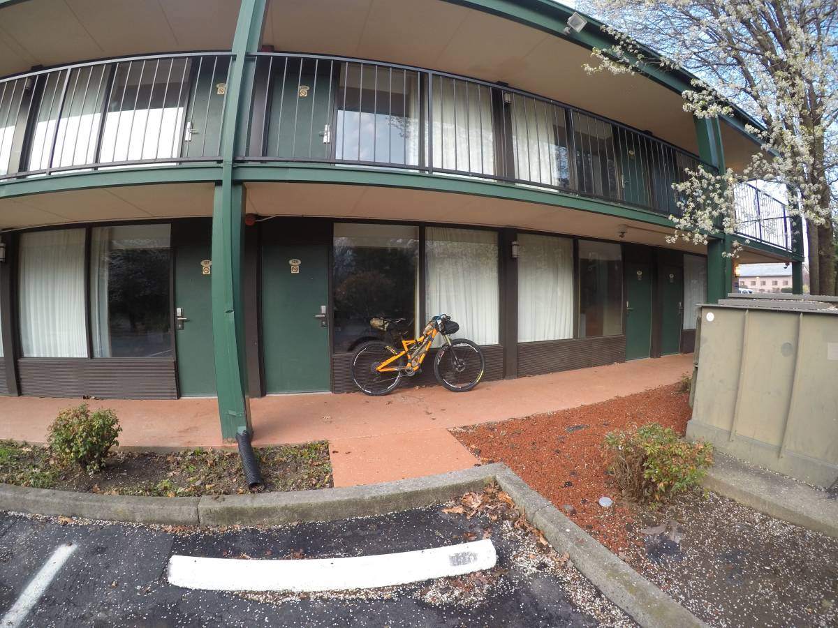
A little after noon I descended the switchbacks into Covington, exhausted, wet and frozen. It had taken me more than 8 hours to cover the 20 miles from my last camp. The weather was still gloomy, and the hills at elevation around me were still enveloped in clouds of snow. I was not sure if I’d be able to continue, but regardless I knew I was in no shape to spend another evening outdoors in the cold–I was simply too wet and exhausted. With some regret, I found a cheap hotel in Covington and crashed for the night–I’d wait and see what the weather had in store for day 4, and make the call in the morning.
Day 3 progress: 8 hours moving, 175 miles complete
Act IV: Resurrection
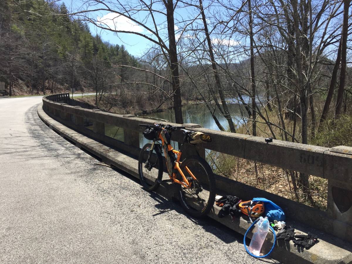
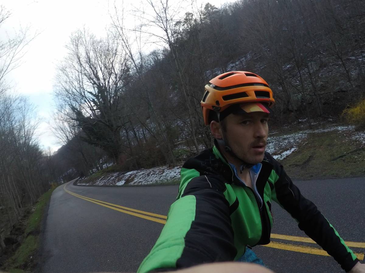
My indoor stay turned out to be the best decision I could have made. The forecast again showed no snow, and the temperatures were projected to climb back into the mid-50’s by mid-day. But even more encouraging was the flurry of phone calls, text messages, and social media posts cheering me on to continue. I took a leisurely breakfast to let the sun come up, and with a rejuvenated spirit and dry clothes set off on my final leg–for I had made the resolve that I would make it to Roanoke today. The course started with a flat road section to Low More, then a 6-mile road climb to Rich Patch–both of which were an great warmup for my tired legs. The miles seemed to fly by and before I knew it I was at the next trail section.
I had never heard of Roaring Run before, but it’s now on my list of places to re-visit sometime soon. Smooth, crushed rock trails climbed thru pine forest to the summit near Iron Ore Knob, then wound down twisty and sometimes technical single track through Pisgah-like groves of lush vegetation and stream crossings. Mentally things were returning and riding the bike was fun again.
After another short road transfer I turned north along the old rail grade thru Craig Valley, and smiled as I discovered the skinny tracks of the gravel riders who had passed through here the night before.
My respite was soon over, and I turned off the gravel road onto Price Mountain for more backcountry goodness. Probably the most remote portion of the trip, Price Mountain is an undulating Ridgeline with panoramic views of the surrounding hillsides. Sometimes wild and overground, other times too steep to ride my loaded bike. The miles came slow, but they were worth it.
By this point it was early afternoon, and I tried to plan out what the remainder of the ride would look like. I really wasn’t interested in another day on the trail, and preferred to take a last massive pull to Roanoke. While there were several lesser trail sections ahead, the major obstacle remaining was Dragon’s Back–a 12 mile rocky spine just west of Roanoke. A quick calculation said at my current pace it should take about 3 hours to traverse, which if I was to get off the ridge before dark meant I’d need to hit the trail by 5 pm. Not really having any options but to press on I sailed along Prince, then down to a series of more gentle connector trails along Lee’s Creek. I reached Stone Coal Gap a little before 4:00 pm, and struggled up the unforgiving climb to collapse in a pile for dinner a half-hour later.
The initial climb to the top of the ridge was brutally steep. I was tired and worn out from more than 9 hours riding and tried to keep my spirits up as I walked the bike to the first summit. The name “Dragons’ Tale” comes from the fact the ridge has more than a dozen individual peaks, some several hundred feet of elevation between them. The initial northern peaks were too much for me to ride up–I’d bomb down to the saddles and then push to the next peak, but the further south I went the more ridable things became.
The miles went slower than I expected, and a few miles from the finish the sun set forcing me to complete the rocky descent in darkness.
Mentally, reaching the trail head along SR-311 was a huge victory for me. It was just after 9 pm, and after getting dinner at the local gas station I hit the pavement again off towards the managed trails at Carvin’s Cove. There was a bit more climbing than I expected, both on the road to Catawaba and over the ridge at Carvin’s but the miles passed without incident. Just before midnight I crossed the Roanoke city limits sign, and followed the course down towards the greenway for the final victory lap to the Roanoke Star and to the finish.
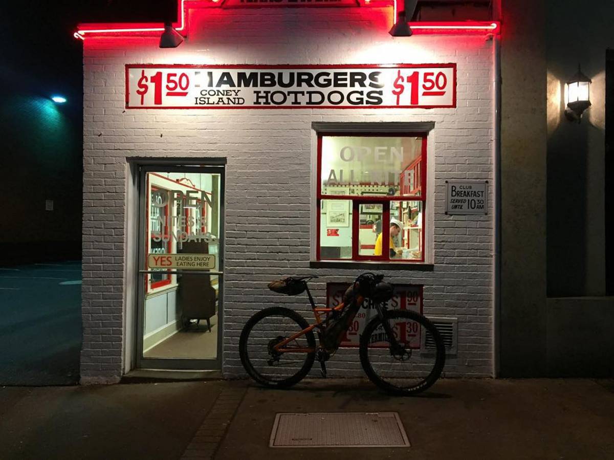
Of course, it wouldn’t finish quite as I expected, as there were a few more challenges in my way including my Garmin that decided to end my route early at Mill Mountain (backup app on my phone saved the day) and an encounter with a security guard at the Roanoke Star who escorted me off the mountain since it technically closed at 11:00 pm. Cold, worn out and sore, I glided through the streets of Roanoke and finished at the Texas Tavern just before 2:30 am.
Day 3 Progress: 18 hours moving, 285 miles complete.
Final time: 3 days, 19 hours, 27 minutes. Good enough for first place overall Trail, and the first person to ever complete the entire Rockstar VA Trail route. I’ll take it.
Epilogue
Overall the race was pretty intense. Most of the time it didn’t seem like a race against others, but more like a race against my own personal abilities. As in mosts endurance events, there was plenty of time to reflect during the race and question my own sanity. Looking back I’m glad I made the decisions I did, and glad that I stuck to my plans even when things looked bad. I’m sure had the weather been different it would have been a different experience. Not better or worse, just different. Will I be back? It’s a bit too close to the event to say for sure, but let’s just say “time heals all wounds” and I’ve already been thinking about a few other events that look like they could be, let’s say, “challenging”?
Credits
I can’t really thank everyone who had a hand in this experience, but I’ll give a few shout-outs:
- Rob at Rockgeist for his packing and strategy guidance
- Phil at Haymarket Bicycles for getting my rig tuned and ready
- Rob at VA Endurance Series for dreaming up this crazy event in the first place
- Jared and my SEAVS/Haymarket teammates for motivating me to stay in shape
- Stephen and the Rodeo crew for encouraging me to dream big adventures
- All my fellow Rockstar competitors for your friendship and support on the trails
- And of course, my dear wife Jessica and the whole family for putting up with my antics the last 6 months getting ready for the event.
Finally, Since lot of folks have asked, here’s most of my gear setup. Email me barry [at] crokers [dot] us if you have any questions!
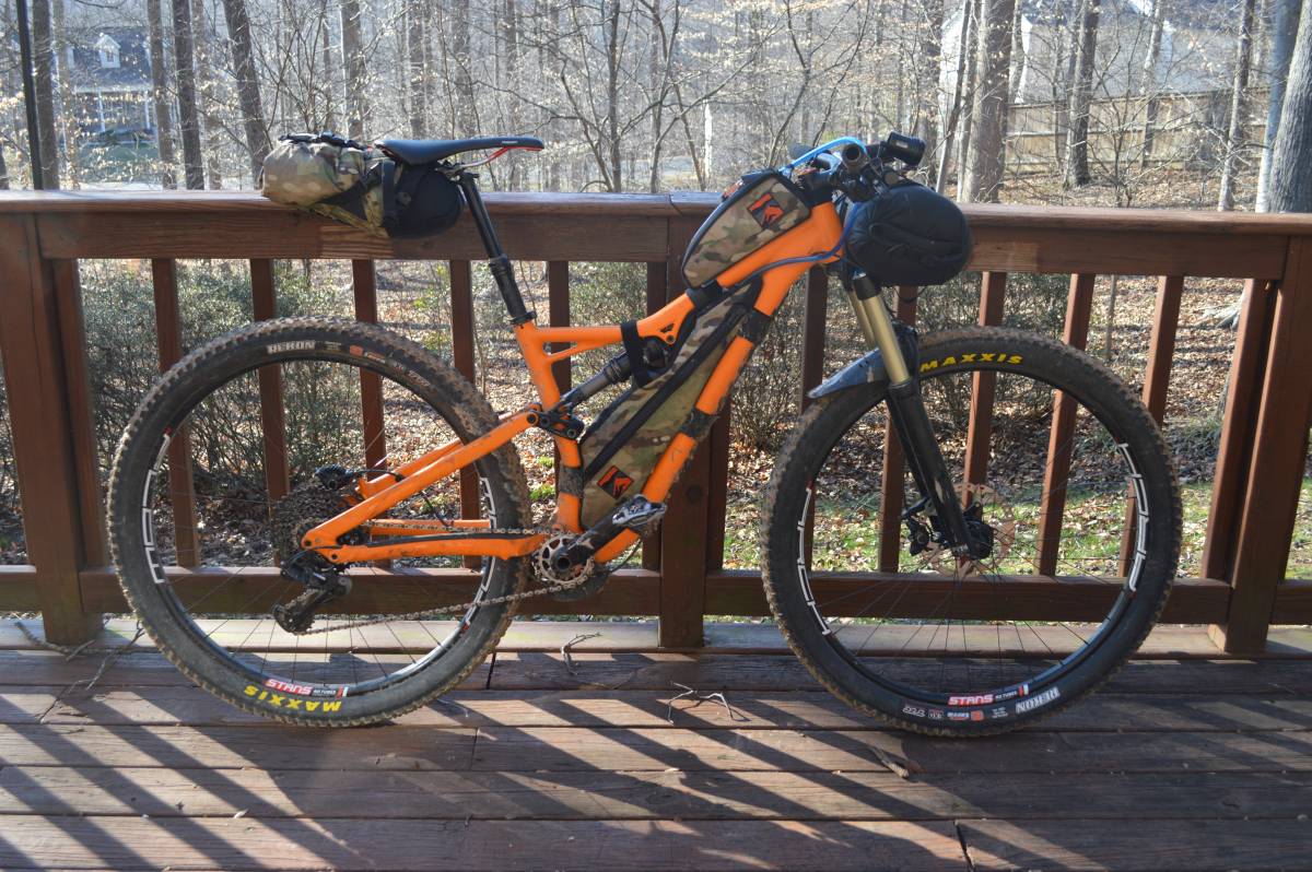
Bike
- Specialized Stumpjumper FSR 6Fattie with 29er wheels. Love the big wheels
- Wolftooth 24T chainring for climbing the gnar
- GX 10-42 drivetrain. Value added and solid
- Specialized dropper for those hard-to-reach places
- Maxxis Rekon 29×2.6 3D/EXO tires. Love love love these tires. Tough, grippy, but aren’t made of lead.
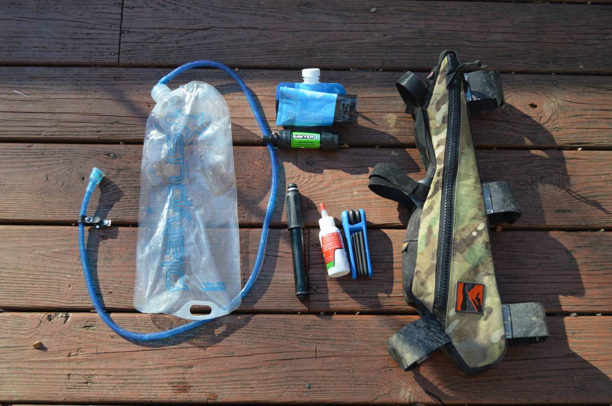
Frame Bag – hydration and tools.
- Custom Mudlust bag from Rockgeist
- 2L Platty bladder with custom-fitted insulated Camelbak hose (not shown)
- Sawyer mini filter and squeeze bag
- Lenzene pump. The little one with the tube
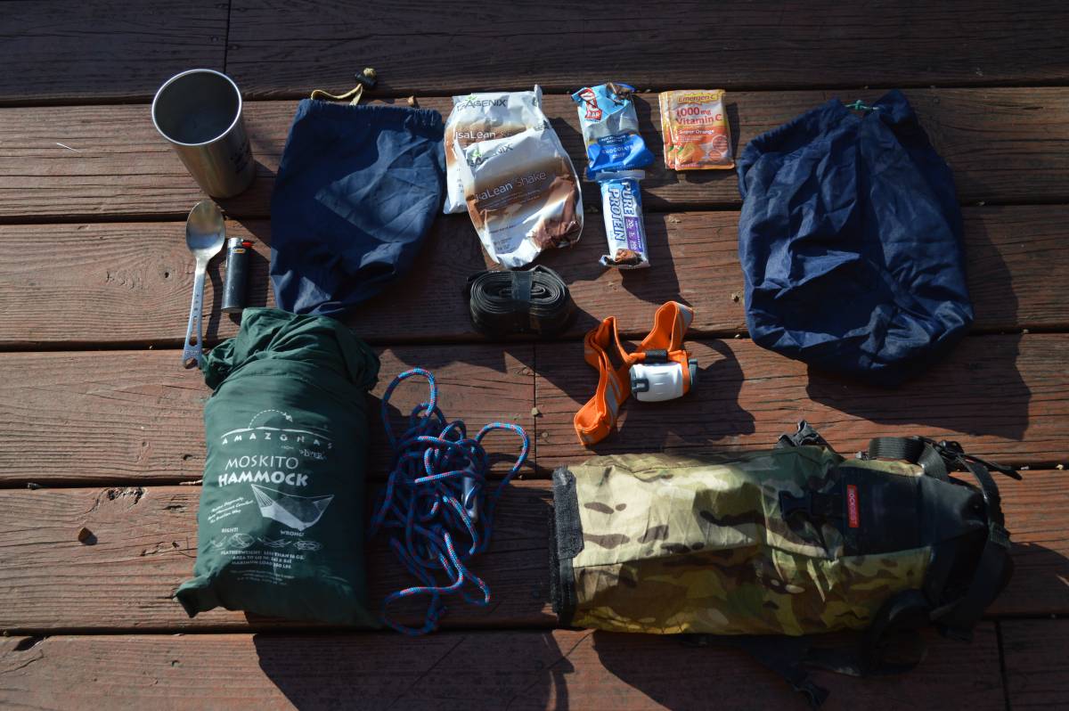
Seat Bag – extra food, gear, and spare clothes
- Rockgeist Gondola. Lightweight and dropper friendly
- 29er tube
- Petzel headlamp
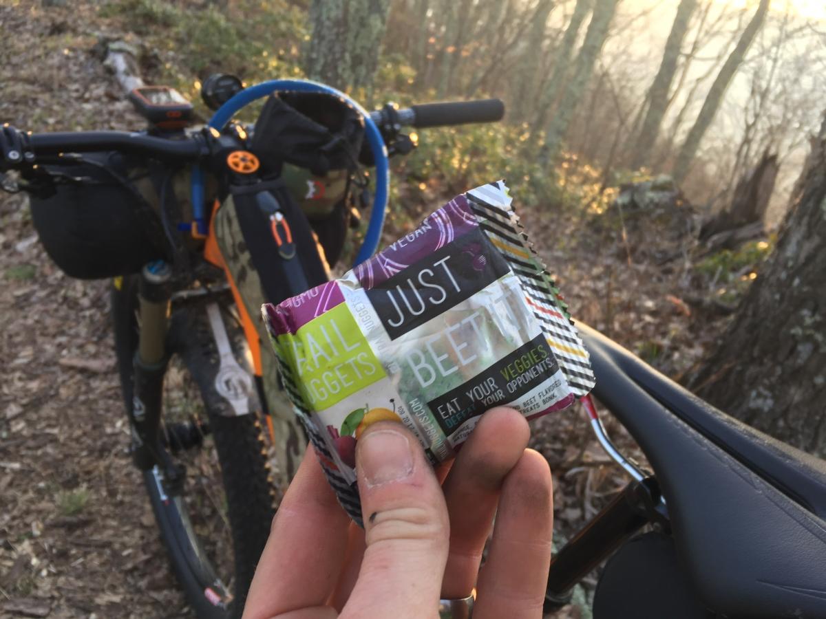
Moskito Hammock(decided to go waterproof bivvy instead for race)- Spare Trail Nuggets and foodstuff
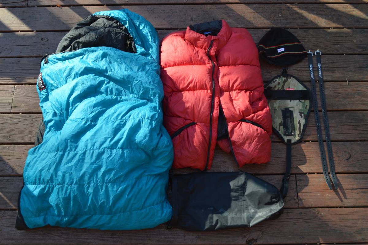
Handlebars – sleeping system
- Rockgeist Barjam harness and Volle straps
- Sea to Summit 8L dry sack
- Marmont 800 fill 20 deg bag
- Feathered Friends Helios 800 fill PTFE jacket
- SOL escape survival bivvy
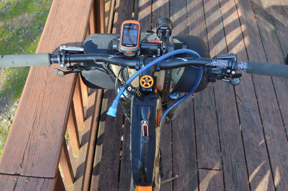
Cockpit
- Garmin eTrex 20x
- Exposure Revo light driven by Shutter Precision PD-8X hub
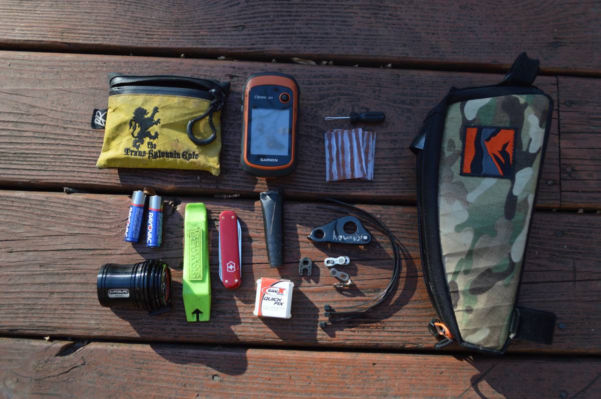
- Rockgeist Cache gas tank
- Pedros love levers
- Swiss Army Knife
- Gorilla tape
- Instant patches
-
Spare AA for Garmin and AAA for Spot
-
Backcountry Research Pouch
- Tire plugger with extra bacon
-
Zip ties
- Spare derailleur hanger
- 2 universal links
- Valve core tool
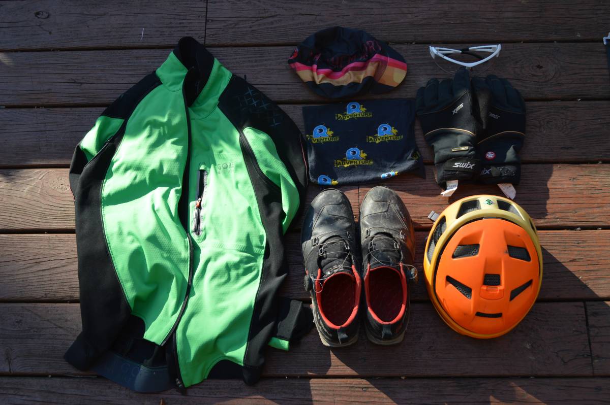
Clothing
- Gore bike Wear windstopper jacket/vest
- Gore Bike Wear windstopper pants (not shown)
- Smith Forefront helmet
- 5.10 Kestrel shoes
- Swix windstopper gloves
- Specialized SubZero mittens
- Castelli cap
GenericRidge Supply neck gator- Starlight Apparel bibs & jersey
- Smartwool socks
No comment yet, add your voice below!