
I believe Adventure does not have to have a logical purpose.
I believe Adventure for adventure’s sake is reason enough. A reason to try a little harder. To dig a little deeper. To find out what one is truly capable of. And often times, reflection on our most memorable Adventures starts along the lines of “I don’t know what I was thinking, but…”
I would not classify myself as an “adventurist” by any means—I have a half-dozen kids, a demanding job, and other adult responsibilities. But the lure of an Adventure is enough to keep me going thought the minutia of long meetings and tiresome commutes during my daily grind. About a year ago I wrote a note to my buddy G. He and I had spent several rides together on the rocky, technical trails along Massanutten Ridge in George Washington National Forest, Northern Virgina. I had a fleeting vision of something completely irrational and illogical. In short, an Adventure.
On Aug 24, 2014 3:29 PM, "Barry Croker" wrote:

So I've got this crazy idea that we should make an attempt on the Massanutten Ring

after it cools down and before the leaves fall.  You interested?  Would take some

logistics, planning, and luck. Interested?
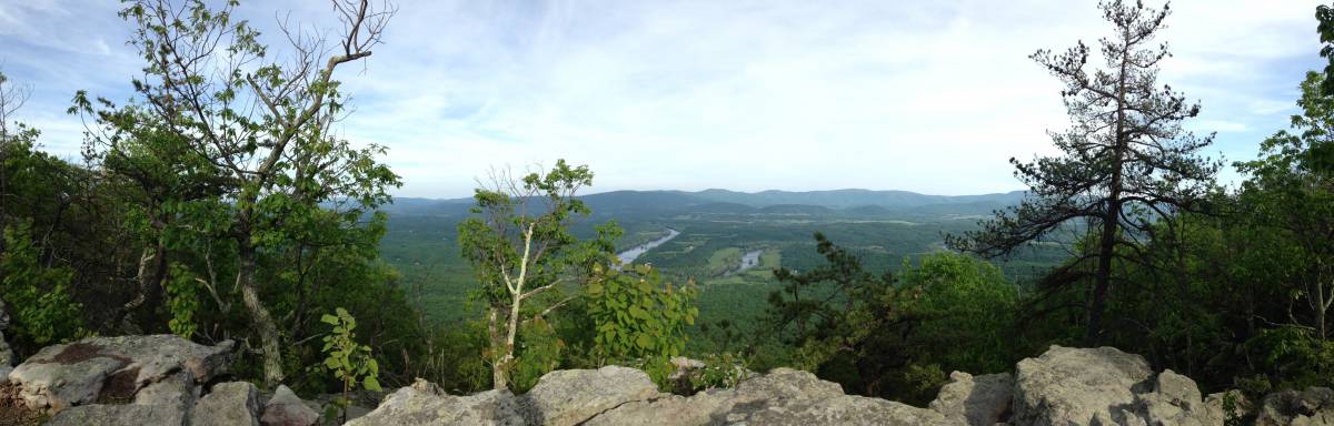
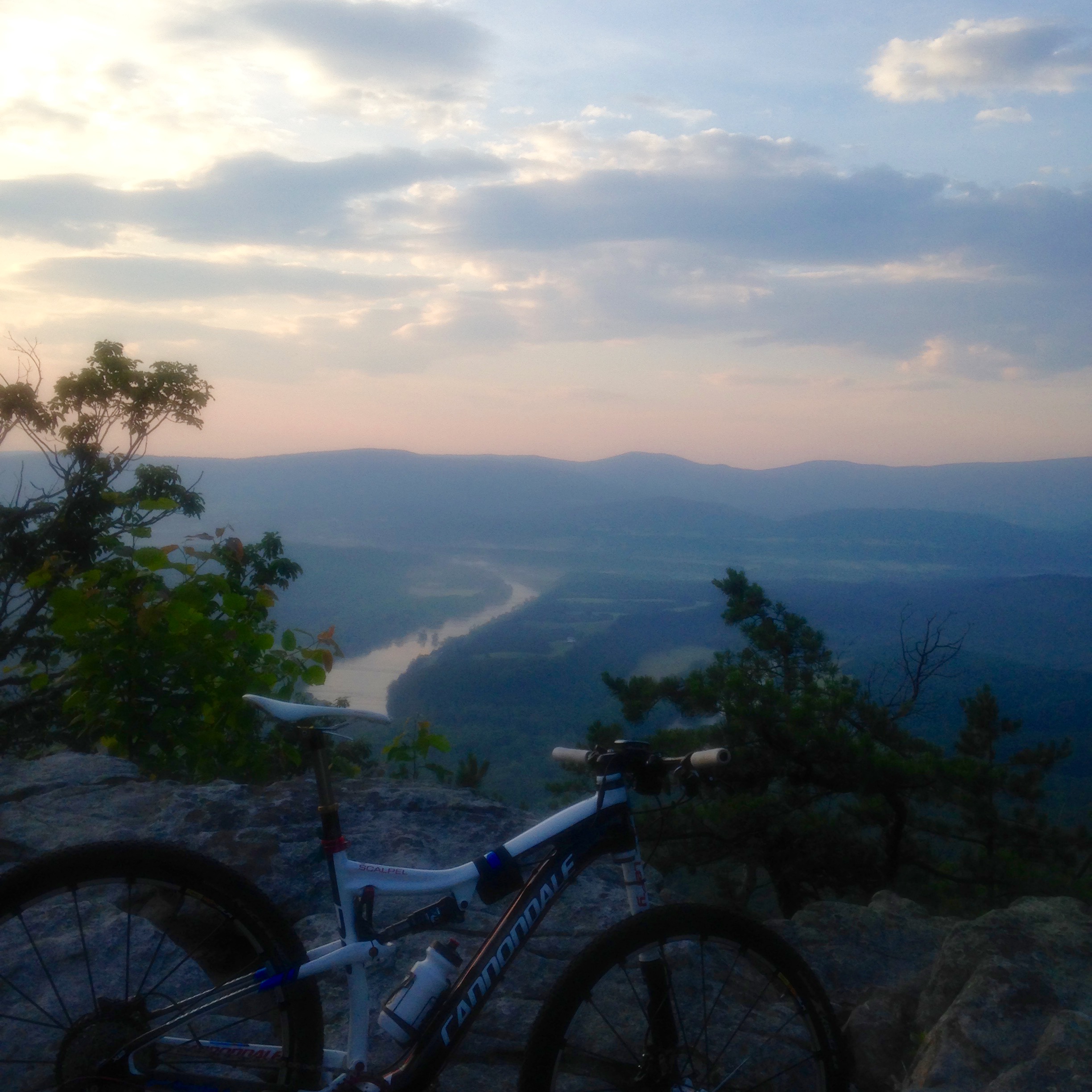
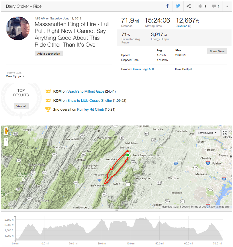
The Massanutten Ring, or simply “The Ring”, is a 68-mile loop along the ridges of the eastern and western Massanutten Mountains, encircling Fort Valley. The Ring is hard, rocky, and brutal. While many of the trails that compose The Ring have been around for more than a century, the entire 68-mile “Massanutten Trail” was not stitched together into a full loop until 2002. In the same year it was created, several local ultra-marathoners took it upon themselves to complete a one-day, “full pull” running the ring, now an annual invite-only event. But it was not until 2012 that two riders from Harrisonburg, Kyle Lawrence and Mike Carpenter, made the first successful “full pull” on mountain bikes. Mike in 17 hours, Kyle in 19 hours. A long, very hard day.
There have been anecdotal stories of others attempting to complete the full ring, but the only evidence points to aborted tries—thunderstorms, darkness, broken bodies. Sam Koerber and Jeremiah Bishop made a hard-hitting attempt later in 2012, but had to call it quits nearly 11 hours into the ride when strong thunderstorms put them out of light and energy. To my knowledge no one else has successfully completed the entire ring on a mountain bike since Kyle and Mike. Sounded like an Adventure to me.
On Aug 24, 2014, at 5:56 PM, G Smith wrote:

I have considered such an attempt. However, it only takes an afternoon ride on the

burly stuff to remind me what a sufferfest it would be.  A 2 day attempt with a camp

in between is still borderline ludicrous, but maybe possible.
Only problem is I wasn’t interested in two days. It would be a full pull or nothing. Turns out G had put a lot of thought into this ride as well. He had hand-drawn maps with timing cut-offs, and locations for possible re-supplies. And most importantly, he had ridden a marjory of sections of the trail individually, whereas I had only done a few. We never got our plan together in 2014, but the idea was still there in the back of my mind. After much more thought and reconnaissance of a few more segments, I was ready to set a date and make it happen in 2015.
On May 26, 2015, at 5:25 PM, G Smith wrote:

I talked to Kyle Lawrence about the ring over the weekend. He says, "DO IT". And recommended

starting at the Furnace/Signal lot and climbing Shawl pre-dawn.  He and Carpenter started at

2am. That was their 3rd attempt at it over the years. He thinks without any issues they would

have completed it in around 15 hours.
The date became 13 June. My wife and kids were out of town, so I had all day without other responsibilities. The plan would be to start as suggested from the north end of the loop before dawn and ride with lights until sun-up. I’d pre-station caches of food and water along the route and shoot for finishing around night fall. It would be a long day.
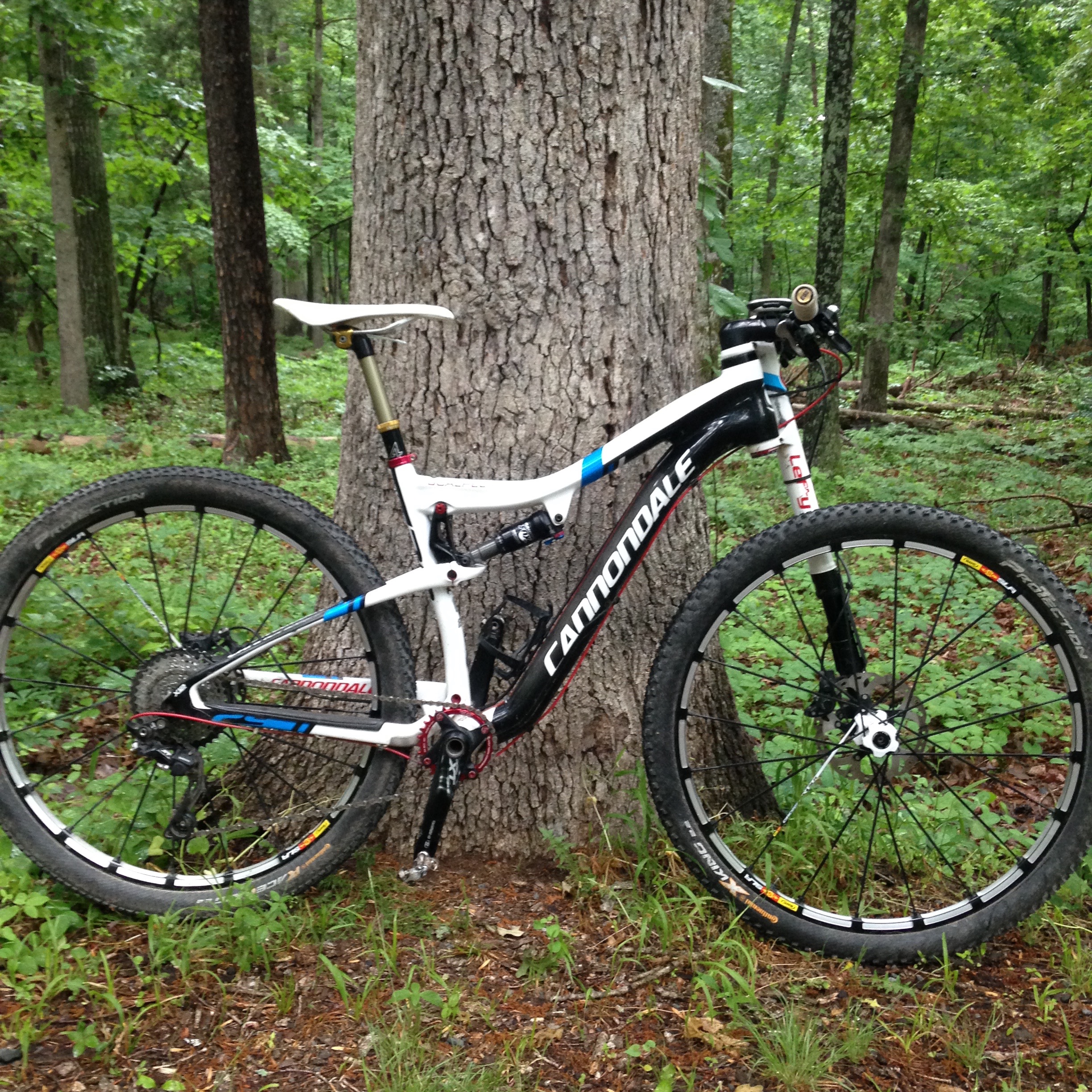
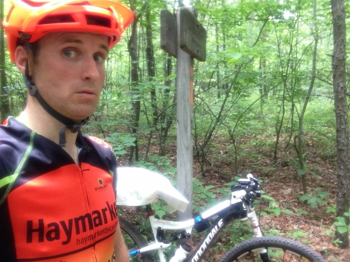
My bike of choice would be my Cannonade Scalpel 29er—not necessarily the best trail bike per say, but it’s the only full-suspension bike in my garage. Ideally a longer-travel trail bike would have been perfect, so I softened the Scalpel by making a few modifications from my normal set-up: I swapped out my front chainring to a 30-tooth for rock-crawling, and added a dropper post I got for a bargain on eBay. I also lowered the pressure in both shocks, and had a relatively-fresh pair of Continental ProTection tires (Race-King/X-King combo, my favorite). In the end I was very happy with the set-up.
In my head I went back and forth on start time. If 15 hours was the goal, I’d need to start no later than 5 am to make it back before sunset at 8:45. And even then, there was little margin for error. My solace was I’d ride with my lights all day; if I came up short on time at least I had a way to see myself out in the end. In hindsight I probably should have started a bit earlier to give more cushion on the final stretch, but I wasn’t excited about a prolonged ride up Shawl Gap, in the dark, early in the morning.
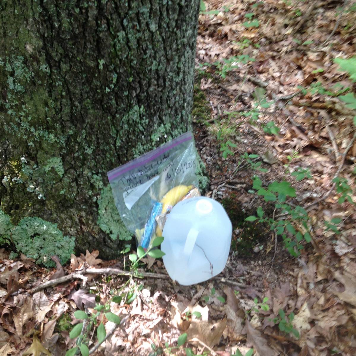
The night before the ride I drove south and stashed two caches for re-supply along the route: a gallon of water and food at Camp Roosevelt, about 20 miles in, and another gallon of water and food at Edinburg Gap, about 44 miles in. I made an effort to stash them out of view, since they would be my lifeline if I were to have any chance of finishing. Pretty standard cycling fare: Clif products, some bananas, gels, etc. And as a special treat, I made a few Nutella and Biscoff Spread sandwiches as a treat.
At 4:59 am I rolled out of Elizabeth Furnace campground ready for whatever lay ahead. It was dark, but warm—already low 70s—and I worried how hot the mid-day would become. As I flicked on my light, I noticed the status indicator wasn’t green, but rather an orange color. “Odd”, I thought, since it had been plugged in the entire night before. I figured at worst it had partial charge and would get me until sunrise. No worries.
The climb up Shawl Gap went well, even in the dark, and my legs felt pretty good as they warmed up. I made an effort to measure my intensity on the technical sections: keep it smooth and no big efforts. Technical uphill sections that I might have otherwise tried to ride I let myself push instead to save some energy. As the Special Forces Operators say, “Slow is Smooth, Smooth is Fast”. I kept it pretty together on the rough descent down, and was happy to turn off my light as the sun rose over the valley below.
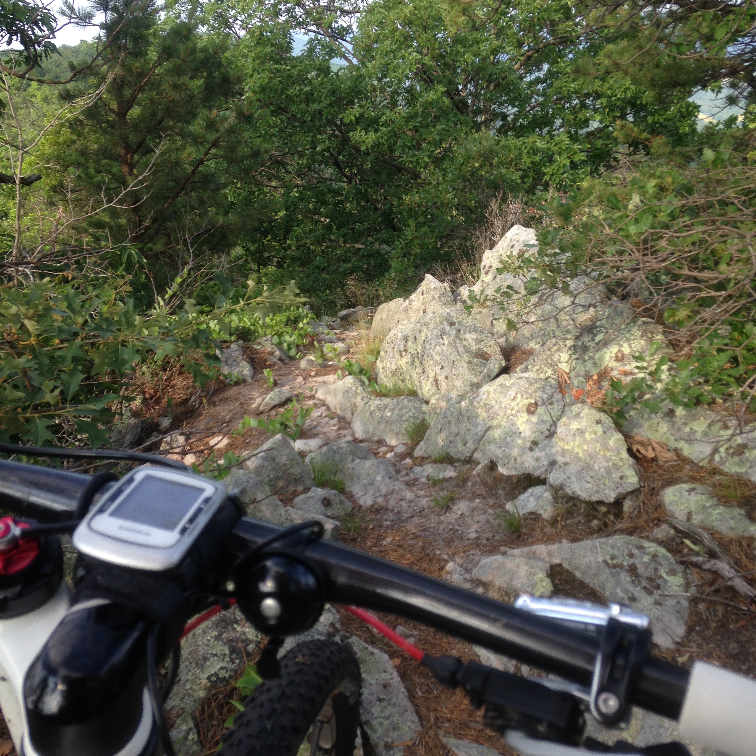
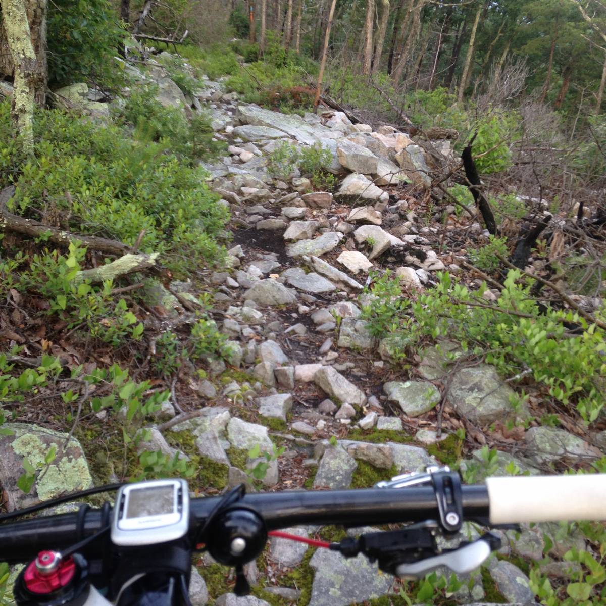
The climb up the east side of Veech Gap is a mile-long, 13% grade which required a steady pace, but again conservatism paid off and I was able to sit nearly the entire ascent. The remained of the way to Milford Gap was probably the most enjoyable portion of the east ridge, with some fast, flowing single track with comparatively little technical obstacles. However, after the short dip to Milford Gap, things start to deteriorate. The east ridge is composed of layers of Massanutten Sandstone that jut vertically; the trail winds between the cracks in these vertical layers and the scree fields they create. Bump and Grind.
About three hours in I had my first twinges of cramping in my inner quads, and realized although I’d been drinking a lot of water, I hadn’t taken any electrolyte replacement. The forecast was for temperatures in the low 90’s with high humidity, and already I was soaked with sweat, so I decided to violate my “only water in the Camelbak” rule and dumped in a half-tube of Nuun and make up for lost ground. On a side note, while I’ve been a Hammer Nutrition guy for a long time, Nuun is quickly becoming my go-to sports drink for it’s ease of use (tabs), flavor, and that cool effervescence.
After a short reprise at the base of Kennedy Peak, I rattled down a short segment towards Camp Roosevelt and my first cache 4:45 minutes of riding complete. My Camelbak did well the first stretch, and went dry just as I was coming into camp. The gallon of water I stashed was enough to refill it, the extra bottle I was carrying, and still have some more with breakfast, which was delicious. After swapping out empty Clif wrappers for new snacks,I was off and rolling again.
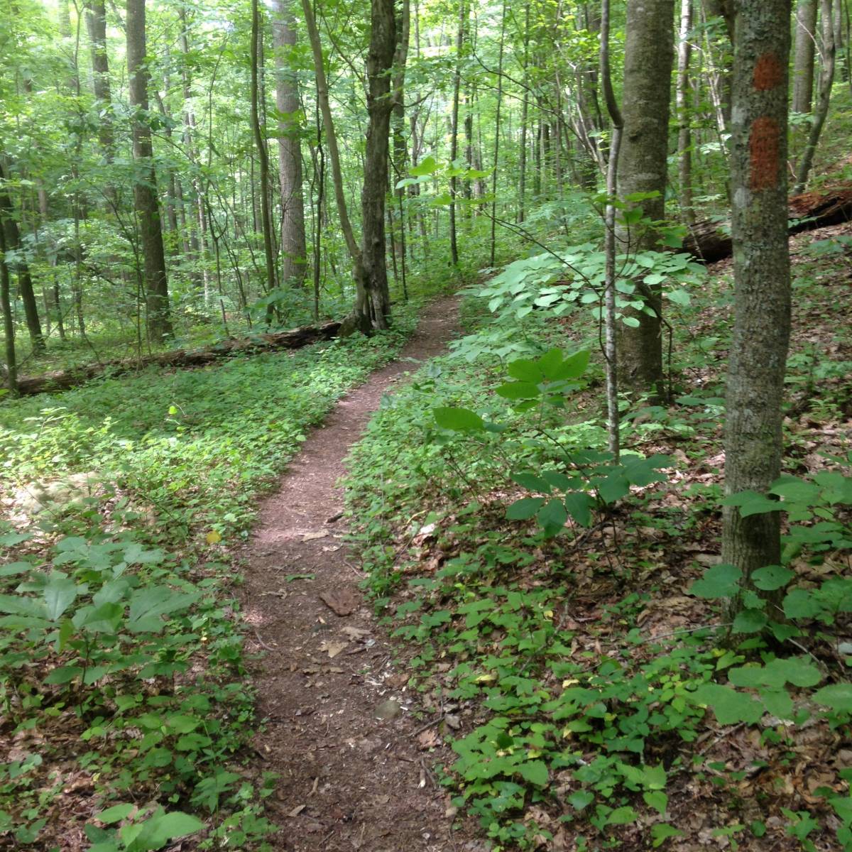
South of Camp Roosevelt the terrain changes to much more moderate (and enjoyable) until you climb back over the ridge. The first few sections of single-track were fast and smooth, which gradually opened up into an old, pebble-covered logging road that gradually climbed the five miles up Duncan Hollow. This stuff was fun, and for a while it didn’t even feel like I was in the middle of a marathon Adventure–just out for a ride in the woods.
The bottom the road was full double-track width, but near the top the passage narrowed as the brush and brambles crept their way into the path, making it feel like a mountain top stage in some grand tour where the fans encroach and the riders squeeze between. Only in this case, the “fans” were blackberry bushes, loaded with green fruit, who lashed out violently at and snagged any passers by. It was sunny, hot and steep, and I chose to force my way through the snarls rather than try to come away unscathed. My arms and legs certainly paid the price.
Over the top of Duncan hollow brought a fast and fun downhill towards the southern tip of my journey, which meant the next major obstacle would be the infamous “Waterfall” climb, a half-mile, 25% grade slog that is completely un-ridable even on the best day with fresh legs (and certainly not 6.5 hours in). This was my first major crisis of the ride. The slog was so hard and steep I had to resort to counting steps and allowing myself breaks to not stop moving. 50 steps. 10 second rest. 50 more steps. In the end, that half mile took 30 minutes, plus another 10 minutes rest at the top to get my head back together.
The east ridge and Waterfall had been hard, but I knew in the back of my mind the worst was still to come: Kern Mountain (known as “Jawbone”) and Short Mountain. I’d ridden Short Mountain before, albeit from the opposite direction, but Jawbone would be entirely new. It started out mellow enough, but rapidly deteriorated into scrambles, scree, and rock moves too hard to pull with my worn-out legs. I spent a lot of time walking. Things opened up slightly on the descent, but around 1:00 pm the clouds rolled in and an afternoon thunderstorm opened in the valley to my left. The treed canopy offered some protection from the lightly falling rain, but it still left the ground and rocks slippery and damp. I didn’t really see stopping as an option because had it been dry, the trail still would have been too technical to ride, so I continued my march. After about 30 minutes, I could see the sunlight through the clouds once again and decided to press on; sure enough the rain was gone by 2:00 pm, and things began to dry out ever so slightly.
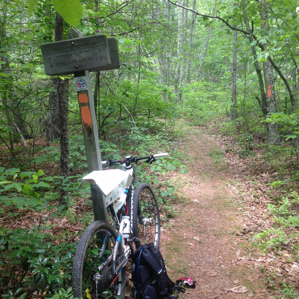
The last obstacle between me and my second food cache was Short Mountain, and by this point I was really looking forward to my second Nutella and Biscoff sandwich (not to mention the jug of water). The final descent from Jawbone Gap was more ridable than the ascent had been, and after some rolling single track the trail emptied out on SR374. At this point, there are two ways to get to Edinburg Gap: 6 miles along SR374 along the graded dirt road, or 8 miles up and over Short Mountain. The Massanutten Trail follows up and over Short Mountain. I’ll admit, the prospect of getting to Edinburg gap in 30 minutes sure sounded tempting, but instead I stuck with my plan and humped it up Short Mountain. As mentioned, I had ridden Short previously from the other direction, but this direction seemed far slower. Maybe it was just that by this point I had been riding for more than 9 hours and was a bit tired. I would eventually take me 2 hours and 30 minutes to make it over Short and down to Edinburg Gap.
With the taste of dinner on my lips I rolled into the parking lot near Edinburg Gap and headed towards my food cache. To my horror, I saw there was an opened Clif Shot Blocs wrapper lying on the ground…someone (or something) had been into my cache! Of course in hindsight, leaving food in the wilderness overnight is asking for critters, and that night some animal got a great dinner of my Sandwich, a Clif bar, and some Shot Blocks. I was pretty devastated, but fortunately there was still a banana and assorted other snacks. The jug of water had also gone unmolested. Some quick math convinced me I’d have enough calories if I rationed properly, but would have to be careful what I ate when. Man, I missed that sandwich.
The trail headed out of Edinburg follows an ATV road for about a mile before turning west up Waonaze Peak. The road is sandy, hot, and about 8% grade, so I put my head down just trying to keep a steady pace. Unfortunately I was so focused on not stopping that I completely missed the turn-off…and didn’t notice my error until I started descending again. With map in hand I tried to judge how far past I was, and decided instead of descending all the way back to the turn-off, I’d try to catch the next spur to the left (Bear Trap) which would get me back onto the Massanutten trail. This plan should have worked, except I also missed the left-hand spur and ended up riding about a mile out of the way. I wouldn’t say I was lost, as I could have always just ridden back to Edinburg, but it certainly was frustrating to be so close but not have any idea where the right trail was. After some searching I finally found the (unmarked) turn off, and bumped up to the Massanutten trail again, back on track.
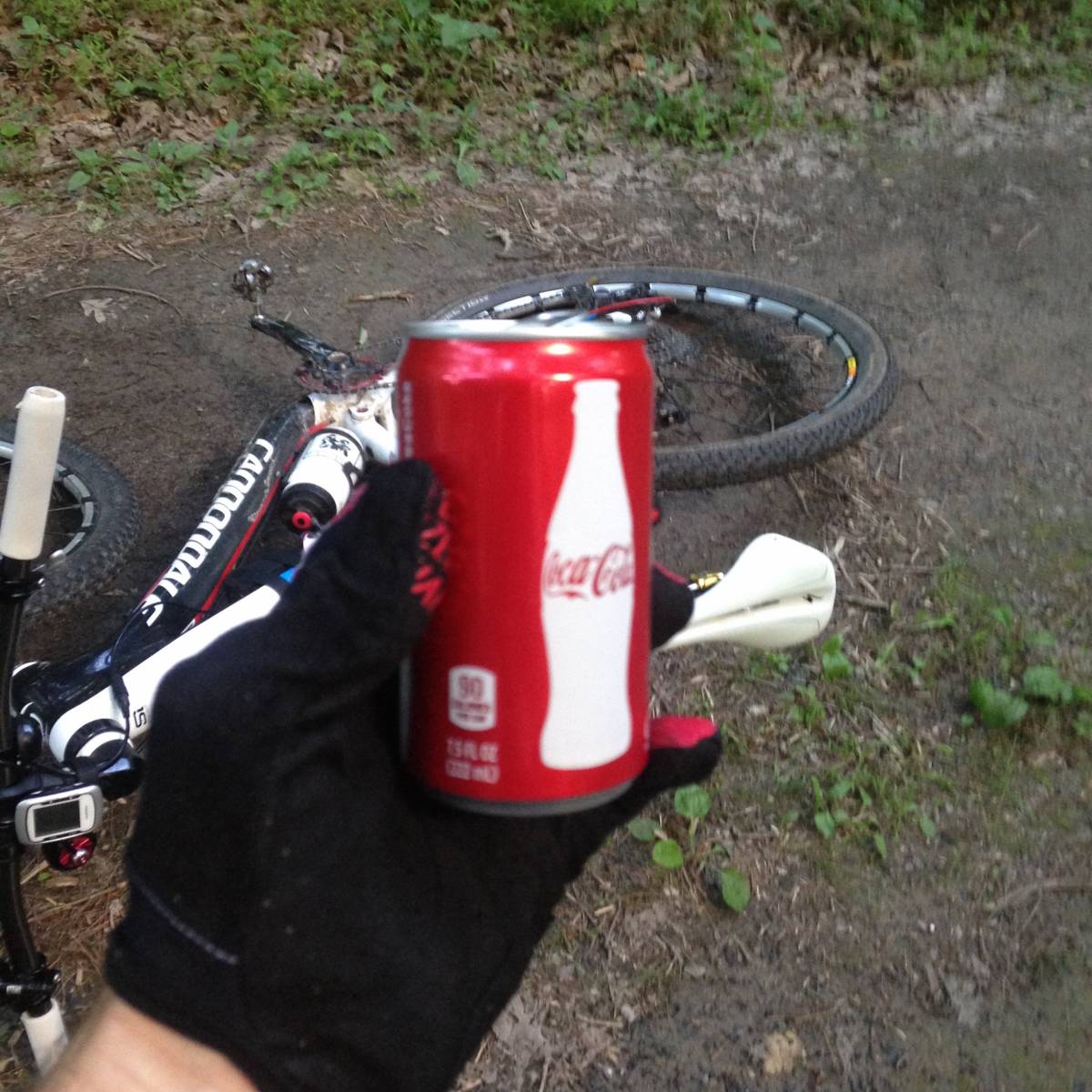
The next 10 miles were probably the only part of the ride that I would call “fun”. The ridge trail from Waonaze Peak, past Woodstock Tower a down to Muddle Gap is mostly non-technical, fast, and has a net elevation loss. I did everything I could to capitalize on the downhill segments and rest my legs, while having no shame on the rocky sections and walking when necessary. Legs were OK, but the daylight was fading. If all stayed on track, I’d be back at the car just at sundown. After descending down to Mudhole Gap, I took the last luxury out of my food cache and drank a can of Coke. I’m not usually a soda guy, but there is something about a can of Coke when you’re at your limit at the end of the ride. My hope was the kick of sugar and caffeine would be enough to get me up and over Signal Knob, and down the bony descent back to camp.
The west side climb to the top of Signal Knob is a long, gradual washed-gravel road. Not the crushed kind, but the miniature river-rock kind that’s shifty under your tires. The climb starts innocently enough, but kicks up the last hundred yards to over 13% grade, which meant I was going to be walking again. After some efforts, near the top I noticed that my rear tire was nearly flat—it probably had less than 10 psi—which definitely didn’t make the climb any easier. I had already spent one CO2 canister re-sealing a burped front tire back on the Mudhole Gap descent, so I used my second to firm up the tire before the last 4 mile, 1,500 foot descent back into Fort Valley.
With my slow leak and spent legs the climb to Signal Knob took longer than I expected. The sun was just going down over the west mountains as I set off downhill, so I flicked on my headlight which illuminated the darkness. I should say just “set off”, because there sure was a lot more uphill sections on the descent than I seemed to recall! My mental state was deteriorated and I was so physically exhausted that I had to take extreme care over the rock gardens. If there was any chance I could not ride a section, I chose to preemptively dismount and just walk it. No shame at this point. My headlight still indicated an “orange” status, but showed no sign of dimming so I slowly rode in a small bubble of brightness and eased my way down.
About 1.7 miles out, the Signal Knob trail takes a sharp right-hand switchback to the fall line. With my limited headlight tunnel vision and the exhaustion of the day’s effort, I completely missed the switchback and slowly rode down the mountain in the wrong direction. It wasn’t until I reached the bottom of the ravine that I realized I was off-course. And almost at that exact moment, when I realized I didn’t know where I was, my headlight died and I was plunged into total darkness.
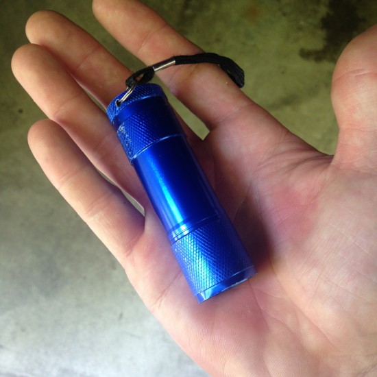
My first thought was to just lay down and go to sleep. It sure would have felt good. But then after a quick prayer I realized I had another option. The day prior, when I was packing up and getting ready to go, I grabbed my keys off the key hook by the door. Under my keys was a small, blue, AAA-powered flashlight. I had the distinct impression that I should grab it and put it in my bag. “Just in case” I thought. Now I knew why! So after a few minutes digging I found the light in the bottom of my pack. As I held my breath and pushed the button, it dimly shined to life (although only providing enough light to see to my feet). After consultation with the map, I grunted back up the hill, found the trail, and started walking downwards—riding wasn’t really an option with the amount of light the flashlight was putting out–just enough light to discern between trail, rock, and woods. Thinking it might be faster to kick-push than just walk, I climbed over my bike to try and sit and instantly my rear tire burped and lost all of it’s air. And then it started raining again. And I was done. In hindsight I probably could have changed the tire (with my pump, since I was out of CO2) and ridden down faster, but I was so mentally done that I just grit my teeth and walked out. It was slow, and my flat tire made a lot of noise, but it was moving towards camp and that was all that mattered. And so just before 10:30 pm, more than 17 hours after I left, I arrived back to my car, laid down on the pavement, and closed my eyes.
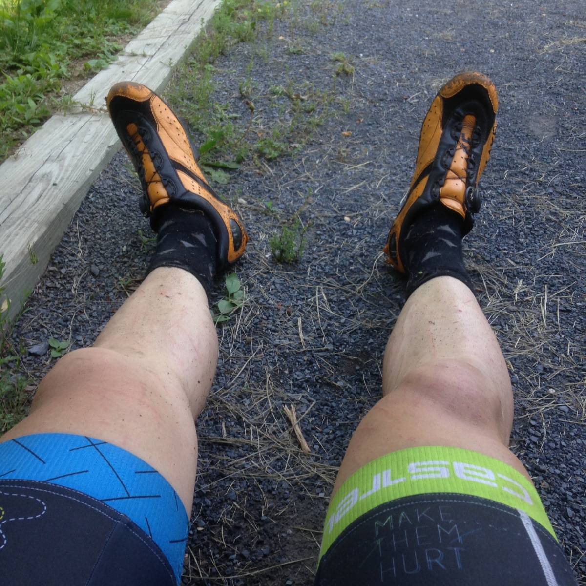
The days events took quite the toll on my body. My fancy carbon-soled shoes, (which were already cracked, BTW) self-destructed leaving my toes vulnerable to errant rocks as I hiked. I’m pretty sure I’m going to lose at least three toenails, if not more. The blackberry bushes punished my arms and legs, and I’m not sure when the poison ivy is going to kick in. My back is tired from the Camelbak, my quads and calves tweak when I climb the stairs. But other than those ailments, I feel pretty good. No bonk. No major crashes. Just a lot of effort.
If I actually thought through how hard this ride would be ahead of time—how much suffering I’d have to endure through—I’d probably have never done it. I really wanted to do it in 15 hours, and was so close. But looking back the pains certainly did not outweigh the rewards. Maybe now I can say I’ve done something only two other humans have ever done. But maybe it doesn’t really matter. Seems like I find myself thinking that in a lot of adventures. Long races. Hard rides. If I thought about it enough I’d probably sell my Mountain Bike and stick to an easier sport. But where would that leave me?
Prior to attempting the first ascent of the world’s highest mountain, a newspaper reporter asked the alpinist George Leigh Mallory “Why do you want to climb Mount Everest?” His answer was simple: “Because it’s there”. The Massanutten Ring Trail is there, and it was made to be traveled. Which is exactly what I did.
2 Comments
Barry,
Now you have gone and done it. Sue Haywood had mentioned this several months ago when I was doing one of her skills camps. After your write up, I am a little more than interested in giving it a go. If not this fall, then next spring. Would you happen to have a GPX file? I am from Tennessee and not familiar with the area.
Super congrats on finishing this thing, with the little hiccups you incurred along the way!
Carey
As a 3 Time Finisher of The Ring and 3 Time Finisher of Reverse Ring, well done sir! Loved your write up on the Orange. Felt your pain on Waterfall-and you were carting that bike!
You missed the trail coming out of Edinburg-there is orange trail there along that unpaved ATV road that you took.
Also, there is a good water source at Powells Fort, on the road on the way to Signal Knob. It’s on the left, the direction you took, just past all those old cabins. There is a gate there, which has usually been closed-the spring is on the left with good water, we’ve drank it for year.
Now you have to do it in the other direction..